Airbus and JDE Peet’s Team up for Worldwide Coffee Plantation Mapping with Satellites
Companies Mentioned
Why It Matters
High‑resolution, AI‑driven mapping gives the coffee sector early deforestation alerts, bolsters sustainable sourcing and safeguards the livelihoods of millions of smallholder farmers, establishing a new benchmark for climate‑smart agriculture.
Key Takeaways
- •Airbus provides 30‑cm resolution satellite data for coffee mapping.
- •Mapping covers 1.2 million km² across East Africa now.
- •Initiative targets global coffee‑region coverage by 2027.
- •Partners include major traders, FCDO, FAO, and JDE Peet’s.
- •Open map will help detect deforestation risk for smallholders.
Pulse Analysis
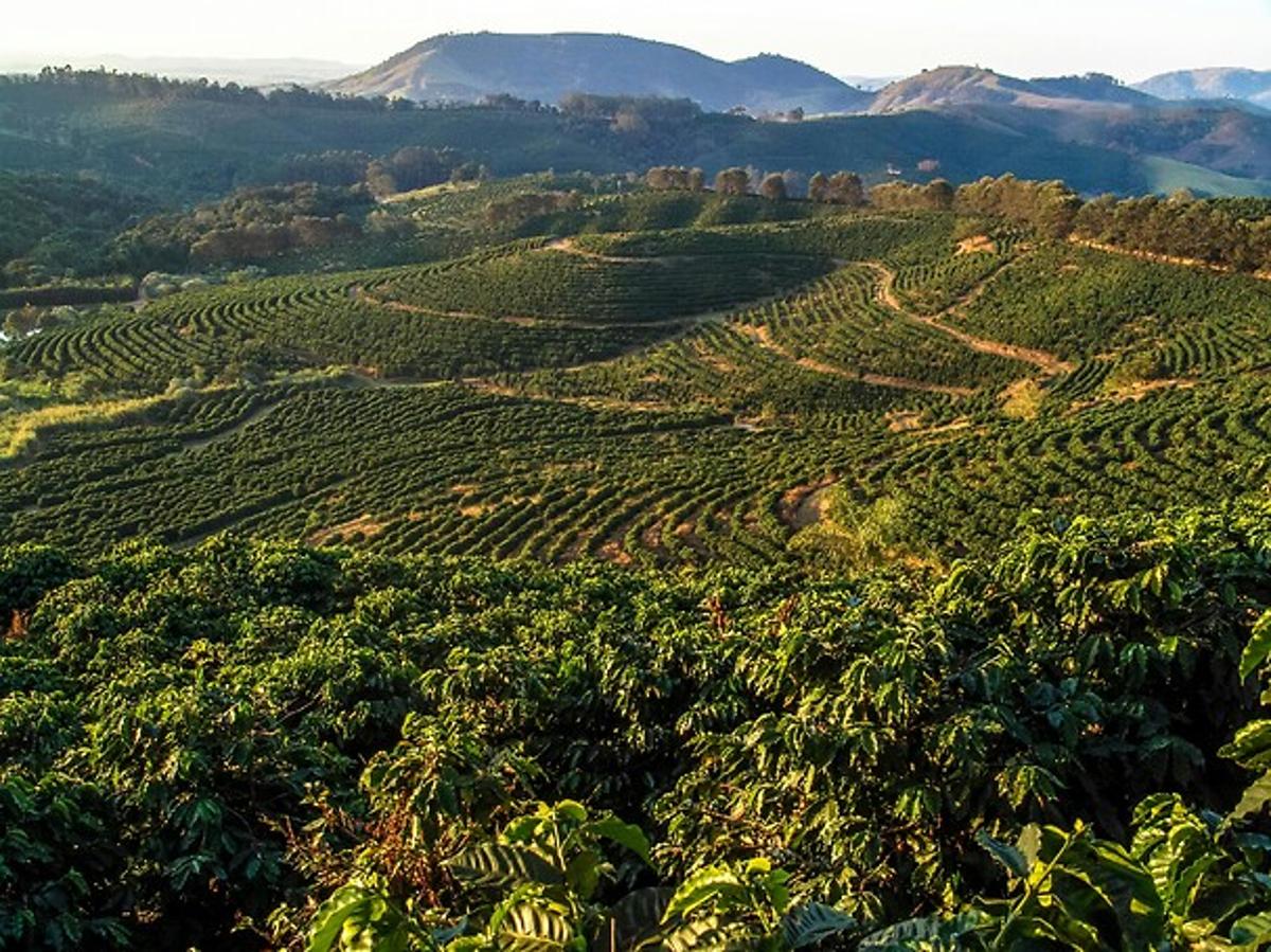
The coffee industry faces mounting pressure to curb deforestation, a driver of both climate change and supply‑chain risk. Traditional certification schemes often cover isolated farms, leaving large swaths of coffee‑growing landscapes unmonitored. Satellite remote sensing offers a way to see beyond individual estates, delivering consistent, repeatable observations across entire regions. By leveraging high‑resolution Pléiades and Pléiades Neo imagery, Airbus can distinguish coffee canopies from surrounding vegetation, a capability that was previously out of reach for most agribusinesses.
Airbus’s AI models, trained on extensive ground‑truth data, translate raw imagery into actionable plantation maps. The current rollout spans more than 1.2 million km² in East Africa, encompassing shade‑grown and agroforestry systems that are often difficult to detect with coarser sensors. The partnership brings together JDE Peet’s, leading traders such as Louis Dreyfus Company and Tchibo, and multilateral supporters like the UK FCDO and UN FAO. Their collective investment accelerates the transition from fragmented, company‑specific initiatives to a sector‑wide, data‑driven approach, with a target of global coverage by 2027.
For coffee producers, roasters and investors, the open map promises earlier warning of forest loss, enabling rapid remediation and compliance with emerging ESG standards. Smallholder farmers gain transparency that can improve access to premium markets and financing tied to sustainable practices. Moreover, the initiative showcases how space‑based geospatial intelligence can underpin resilient supply chains, a model that could be replicated across other commodity sectors seeking to balance growth with environmental stewardship.
Airbus and JDE Peet’s team up for worldwide coffee plantation mapping with satellites
Comments
Want to join the conversation?
Loading comments...