Route 61 Project Eliminates Deadly Curve
Why It Matters
By removing a high‑collision curve and modernizing the roadway, the project dramatically enhances safety for the heavy tractor‑trailer traffic that fuels the regional economy. It also streamlines access to the popular Reading Outdoors Adventure park, supporting tourism and local businesses.
Key Takeaways
- •Project removes 350,000 cubic yards of rock, largest non‑Interstate cut
- •Route 61 reconstruction spans 17.6 lane‑mi, slated for 2029
- •New bridge and signal at Darkwater Road improve park access
- •14‑15‑in. asphalt layer with geotextile enhances durability
- •GPS‑enabled excavators boost precision, reduce grading errors
Pulse Analysis
Route 61 is a vital north‑south artery in Schuylkill County, linking I‑81 and I‑78 while serving commuters, school buses, and freight carriers. Decades of heavy use left the two‑lane highway riddled with substandard curves and eroding pavement, contributing to a disproportionate number of crashes. The "dead man’s curve" near Darkwater Road earned a grim reputation, prompting local officials to lobby for a comprehensive overhaul. This context underscores why a full‑depth reconstruction, rather than piecemeal repairs, is essential for sustaining regional mobility and safety.
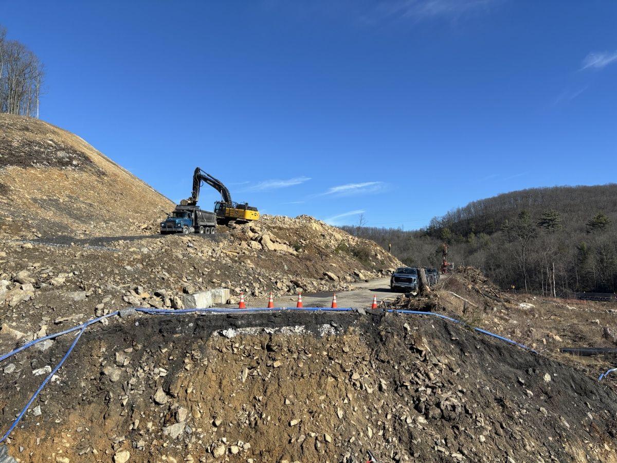
The centerpiece of the $115 million effort is the "big cut," a massive excavation that will remove about 350,000 cubic yards of rock—equivalent to roughly 130 Olympic‑size swimming pools. Contractor J.D. Eckman has deployed a John Deere 470 excavator and a 1050 dozer, both GPS‑enabled, to achieve precise slopes and minimize waste. By repurposing the excavated material for subgrade, the project reduces haul distances and environmental impact. In addition to flattening the deadly curve, the plan includes new culverts, retaining walls, and a single‑span concrete bridge, all designed to accommodate the heavy tractor‑trailer traffic that underpins the local supply chain.
When completed in 2029, the rebuilt Route 61 will feature a 14‑15‑inch asphalt surface supported by a geotextile layer and 8 inches of subbase, delivering a smoother, more durable ride. Wider shoulders and a reconfigured intersection with a traffic signal will improve sightlines and reduce collision risk. Beyond safety, the upgraded corridor shortens travel time to the Reading Outdoors Adventure park, bolstering tourism for its 11,000 members. The project exemplifies how targeted infrastructure investment can simultaneously elevate public safety, economic vitality, and community recreation in rural America.
Route 61 Project Eliminates Deadly Curve
Comments
Want to join the conversation?
Loading comments...