British-Built Brain Lets UGVs Navigate when GPS Goes Down
Key Takeaways
- •IDV's ATLAS provides 10 cm navigation accuracy without GPS
- •System stores pre‑processed terrain maps for on‑board localization
- •Passive operation avoids emissions that reveal vehicle position
- •Integrates with UK/US TAK network for autonomous ISTAR missions
- •Simulation‑trained AI recognises targets despite lacking real‑world data
Pulse Analysis
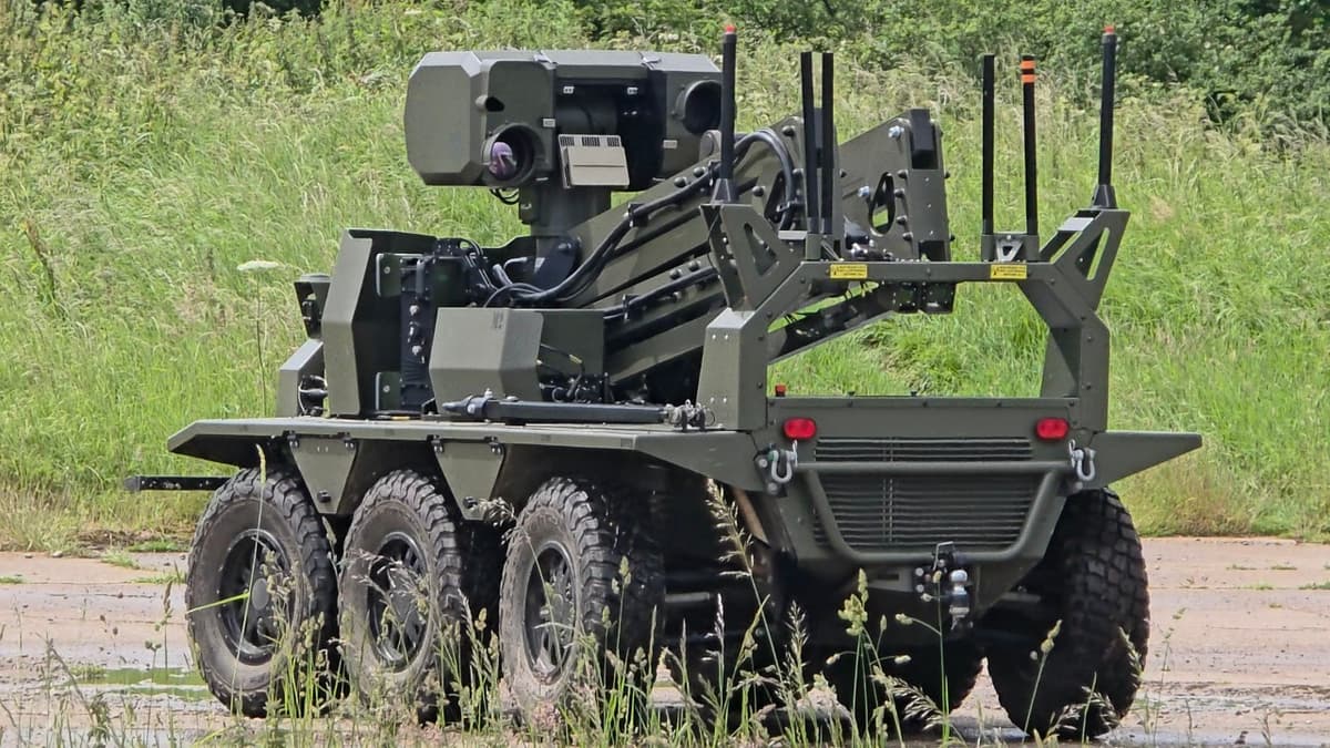
The rise of electronic‑warfare environments, highlighted by the Ukraine war, has forced militaries to rethink reliance on satellite navigation. Traditional GPS signals are easily jammed or spoofed, creating a critical vulnerability for autonomous platforms. IDV’s MACE system addresses this gap by leveraging AI‑generated terrain maps that are loaded onto the vehicle before deployment, allowing it to navigate using visual cues and probabilistic filters. This GPS‑denied capability not only ensures mission continuity under contested conditions but also reduces the electromagnetic signature that adversaries could exploit.
ATLAS, the core of MACE, combines computer‑vision preprocessing of aerial or satellite imagery with convolutional neural networks running on Nvidia hardware. The AI classifies terrain features, compresses them into polygonal boundaries, and stores them in a spatial database. During operation, the vehicle’s cameras compare real‑time views against this stored map, continuously updating its position with ten‑centimetre precision. Operators can manually initialize the system by selecting a grid point, enabling rapid convergence even when no signal is available. The probabilistic filter accommodates dynamic battlefield changes, maintaining accurate navigation despite destroyed or newly introduced obstacles.
Beyond navigation, the system’s passive design and seamless integration with the Tactical Assault Kit (TAK) create a robust digital backbone for autonomous ISTAR missions. Vehicles can autonomously detect, geolocate, and transmit target data as low‑bandwidth thumbnails, feeding commanders real‑time situational awareness. This capability promises cost‑effective force multiplication for armed forces and hints at civilian applications such as disaster‑response robotics where GPS may be unreliable. As defense procurement increasingly prioritises resilient, AI‑driven autonomy, IDV’s approach positions it as a key player in the next generation of unmanned ground systems.
British-built brain lets UGVs navigate when GPS goes down
Comments
Want to join the conversation?