BOEM Releases Offshore Alaska Seismic Survey Data
•March 2, 2026
0
Why It Matters
Opening these high‑resolution seismic datasets lowers research costs and accelerates offshore energy planning, giving industry and academia a richer foundation for resource assessment and environmental analysis.
Key Takeaways
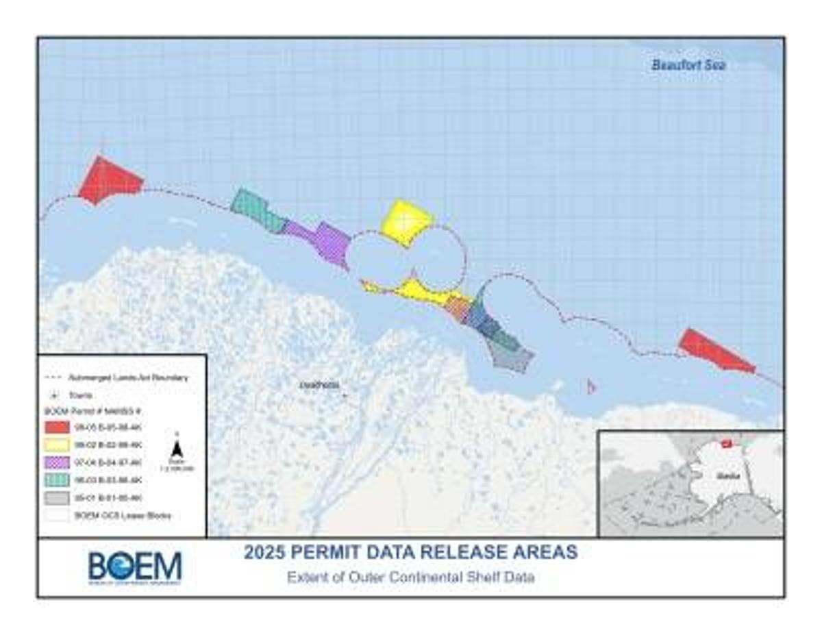
- •Five 3‑D seismic surveys released for Beaufort Sea
- •Datasets cover 232 sq mi across nine survey areas
- •Data now public domain, no usage restrictions
- •25‑year confidentiality period ends, enabling release
- •BOEM plans additional legacy seismic releases rolling out
Pulse Analysis
The Bureau of Ocean Energy Management’s latest data release reflects a broader federal push to democratize geoscientific information that underpins offshore energy development. By publishing five legacy 3‑D seismic surveys from the Beaufort Sea, BOEM fulfills Executive Order 14303’s mandate to restore "gold‑standard" science, while also clearing a 25‑year proprietary hold that traditionally limited access to high‑cost, high‑resolution subsurface images. This move not only preserves historical investment but also creates a public‑domain resource that can be leveraged without licensing fees.
For oil and gas operators, renewable developers, and academic researchers, the availability of 232 square miles of detailed seismic data translates into immediate cost savings and faster project scoping. Companies can now validate prospective lease blocks, model reservoir potential, and assess geohazards without commissioning new surveys, which often run into tens of millions of dollars. Universities gain a valuable teaching and research tool, enabling studies on Arctic geology, climate‑change impacts on permafrost, and marine ecosystem interactions. The unrestricted nature of the data encourages collaborative analysis, spurring innovation across the energy sector.
Looking ahead, BOEM’s commitment to a rolling release schedule signals a shift toward greater transparency in offshore resource management. As more legacy surveys become accessible, stakeholders can expect a richer, more integrated geoscientific database that supports informed decision‑making and regulatory confidence. This openness may also attract new investment by reducing technical risk, potentially accelerating the development of both conventional hydrocarbon projects and emerging offshore wind or carbon‑capture initiatives in the Arctic region.
BOEM Releases Offshore Alaska Seismic Survey Data
0
Comments
Want to join the conversation?
Loading comments...