Viridien Launches Charrua 3D Seismic Survey Offshore Uruguay
•March 6, 2026
0
Why It Matters
The high‑resolution data will de‑risk exploration in Uruguay’s basins, attracting investment and accelerating the South Atlantic’s emergence as a new energy frontier.
Key Takeaways
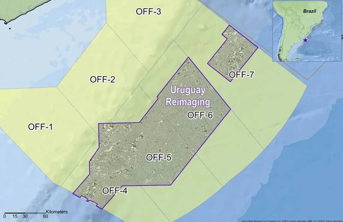
- •Viridien starts Charrua 3D seismic survey offshore Uruguay.
- •Survey uses BGP Prospector vessel with TLFWI imaging.
- •Data aims to de‑risk exploration in southern Atlantic Margin.
- •Targets basins analogous to Namibia’s Orange Basin discoveries.
- •Multi‑client funding supports project, expanding Viridien’s data portfolio.
Pulse Analysis
Uruguay’s offshore basins have long been considered under‑explored, but recent geological parallels with Namibia’s prolific Orange Basin are shifting that perception. By initiating the Charrua 3D survey, Viridien positions itself at the forefront of this emerging frontier, offering a comprehensive seismic footprint that can serve multiple operators. The project’s timing aligns with a broader industry pivot toward the southern Atlantic, where governments are streamlining licensing and offering fiscal incentives to attract foreign investment.
The technical backbone of the survey—time‑lag full‑waveform inversion (TLFWI) aboard the BGP Prospector—delivers unprecedented image clarity. TLFWI integrates low‑frequency data with high‑frequency reflections, producing detailed velocity models that sharpen fault delineation and reservoir characterization. This level of resolution reduces geological uncertainty, allowing companies to prioritize drilling targets with greater confidence and potentially lower capital expenditures. Moreover, the multi‑client structure spreads acquisition costs, making high‑quality data accessible to smaller players and fostering a more competitive exploration environment.
Strategically, the Charrua survey signals a growing confidence in the South Atlantic’s untapped hydrocarbon potential. Successful outcomes could catalyze a wave of drilling activity, mirroring the recent surge in Namibia’s Orange Basin that unlocked a working Aptian petroleum system. As industry funding backs the initiative, Viridien not only expands its data portfolio but also reinforces Uruguay’s credibility as an emerging oil and gas hub, encouraging further capital inflows and collaborative ventures across the region.
Viridien Launches Charrua 3D Seismic Survey Offshore Uruguay
0
Comments
Want to join the conversation?
Loading comments...