Ghost Ships Can't Hide From New Space-Based Tracking System
Companies Mentioned
Why It Matters
Real‑time satellite detection removes a key loophole for sanctioned vessels, strengthening global sanctions regimes and maritime security.
Key Takeaways
- •Mitsubishi's AIRIS satellite enables real‑time ship detection
- •Edge computing reduces data transmission, speeding maritime surveillance
- •Ghost ships using transponder spoofing face new detection risk
- •Partnership includes JAXA, University of Tokyo, enhancing AI capabilities
- •System retrains in orbit, adapting to changing ocean conditions
Pulse Analysis
Since the early 2000s, illicit operators have exploited gaps in the Automatic Identification System (AIS) to conceal the true ownership and routes of tankers and freighters. By switching off transponders or broadcasting false coordinates, so‑called “ghost ships” have slipped past port authorities, enabling sanctioned nations such as Russia, Iran, Venezuela and North Korea to move oil, weapons and other contraband under the radar. Traditional satellite imagery can spot vessels, but the sheer scale of the oceans and the need to download massive raw files have kept real‑time visual tracking out of reach—until now.
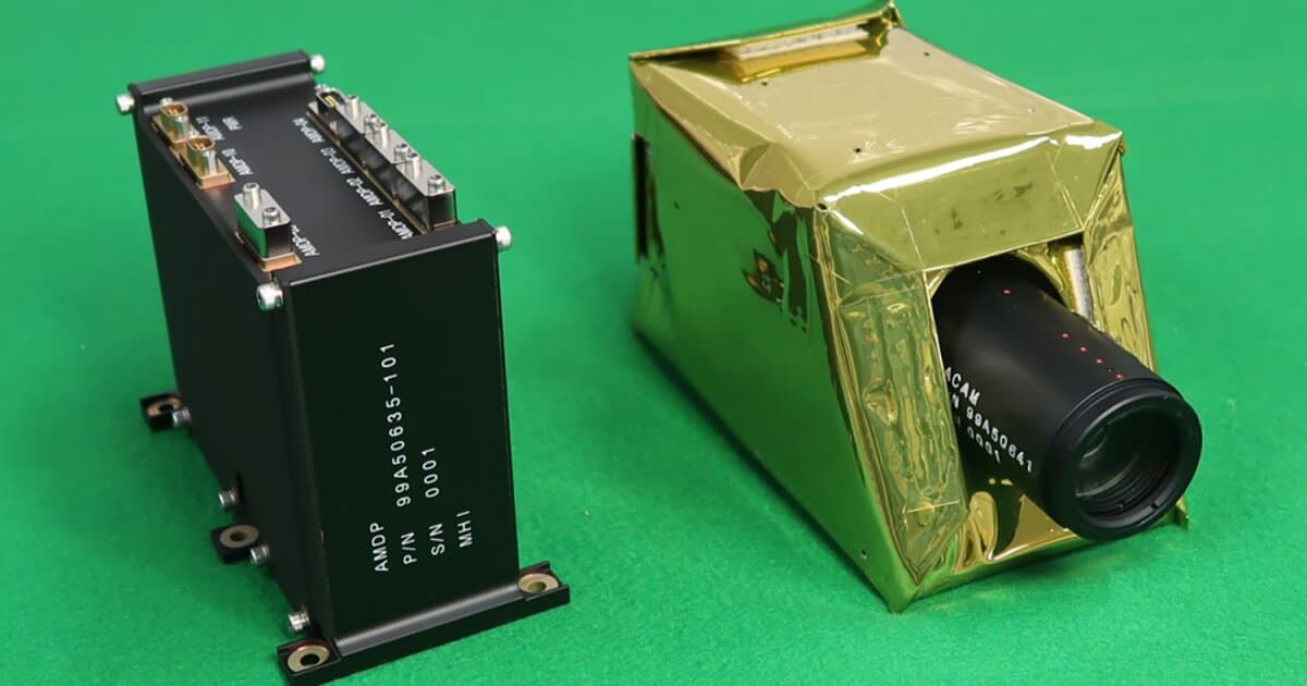
The breakthrough comes from Mitsubishi Heavy Industries’ Artificial Intelligence Retraining In Space (AIRIS) payload, demonstrated on the RAISE‑4 small satellite in collaboration with JAXA and the University of Tokyo. AIRIS fuses a radiation‑hardened processor with a high‑contrast Earth‑observation camera, performing edge detection directly on board. By isolating ship silhouettes against a constantly moving sea surface, the system extracts only the relevant snippets and geolocation data, slashing downlink volume and delivering identification results in minutes rather than hours. Its on‑orbit self‑learning loop continuously refines detection models as lighting and sea state change.
For regulators and insurers, the ability to pinpoint non‑cooperative vessels in near real time could tighten enforcement of United Nations sanctions and reduce insurance premiums on high‑risk routes. Navies and coast guards may integrate AIRIS feeds with existing AIS databases, creating a layered picture that flags anomalies for rapid interdiction. While the technology raises privacy and data‑ownership questions, its commercial potential extends to fisheries monitoring, piracy prevention, and climate‑related shipping analytics. As more nations invest in edge‑computing satellites, the maritime domain is poised for a new era of transparency.
Ghost ships can't hide from new space-based tracking system
Comments
Want to join the conversation?
Loading comments...