TECH PROFILE: Navtech’s 360-Degree Radar for Highway Detection
Why It Matters
The solution lets road operators achieve full‑highway visibility with fewer devices, cutting capital and O&M costs while boosting safety in adverse weather conditions.
Key Takeaways
- •360° radar covers all lanes and ramps in a single unit.
- •Placement focuses on line‑of‑sight; outside curve bends maximize range.
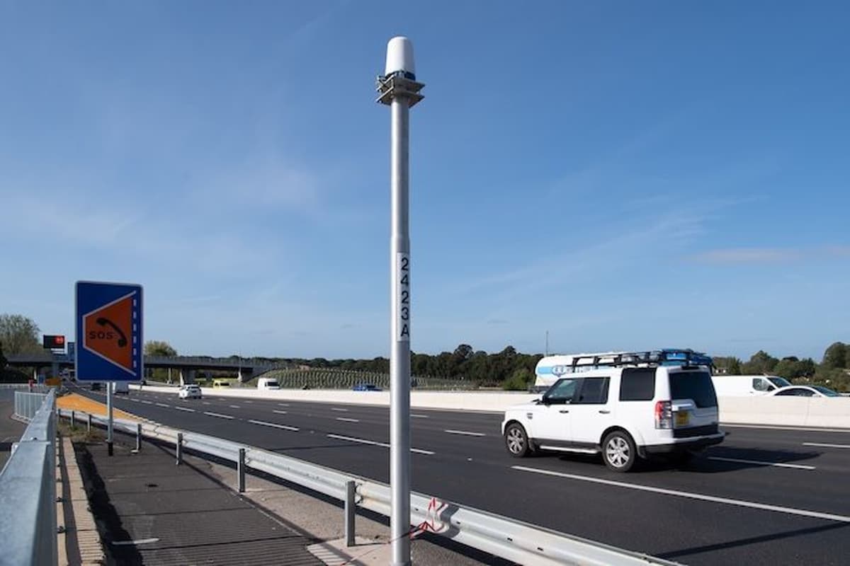
- •Mounts at ~4.5 m using floating‑plate bracket, no maintenance.
- •Integrates via PoE, feeds data to central ClearWay platform.
- •Sweden’s RIDS uses 121 radars over 42.6 km, proven in winter.
Pulse Analysis
Continuous radar coverage is reshaping traffic‑management strategies by overcoming the blind spots that limit cameras and lidar. A 360‑degree field of view captures every vehicle movement across multiple carriageways, while the radio‑frequency spectrum penetrates fog, snow and low‑light conditions that cripple optical sensors. This robustness makes radar especially attractive for regions with harsh winters or frequent low‑visibility events, where incident detection speed directly influences response times and secondary crash risk.
From a design perspective, Navtech’s approach flips traditional hardware‑first thinking. Engineers first define the incident set—stopped vehicles, wrong‑way travel, queue formation—and then calculate the radar spacing needed to meet detection performance metrics. Mounting on the outside of curves and at roughly 4.5 metres height maximizes line‑of‑sight, while floating‑plate brackets allow fine alignment without later adjustments. The system’s reliance on a simple 24 V DC feed and PoE Ethernet eliminates the need for dedicated cabinets, reducing installation complexity and long‑term maintenance, which the vendor estimates at zero hardware service over a ten‑year lifespan.
The commercial implications are significant. Sweden’s RIDS deployment—121 radars across 42.6 km—demonstrates scalability and reliability, encouraging other European agencies and U.S. state DOTs to consider radar as a backbone for smart‑highway initiatives. By consolidating traffic‑volume, speed and occupancy data into a single platform, agencies can retire multiple legacy sensors, streamline data pipelines, and lower total cost of ownership. As autonomous vehicle ecosystems mature, the demand for weather‑agnostic, high‑resolution traffic data will only grow, positioning 360‑degree radar as a cornerstone of next‑generation roadway intelligence.
TECH PROFILE: Navtech’s 360-degree radar for highway detection
Comments
Want to join the conversation?
Loading comments...