What’s the Deal With I-80 and SF’s Central Freeway? Here’s a Brief History
Companies Mentioned
Why It Matters
The closure tests San Francisco’s capacity to manage a critical commuter and logistics corridor, directly influencing regional productivity and the city’s long‑term transportation strategy.
Key Takeaways
- •Caltrans closing eastbound I‑80 between 17th and Fourth streets
- •1996 Central Freeway shutdown showed traffic can divert successfully
- •1989 earthquake spurred citywide freeway removal movement
- •Gig‑economy deliveries now shape post‑pandemic traffic patterns
- •Voter‑approved freeway cuts reshaped San Francisco’s urban core
Pulse Analysis
The imminent eastbound I‑80 closure between 17th and Fourth streets is more than a routine maintenance project; it strikes at the heart of the Bay Area’s most heavily used arterial link. Caltrans estimates significant delays, but the real impact will be felt by commuters, freight operators, and the gig‑economy fleet that relies on predictable routes to serve downtown businesses. As the region’s economy rebounds, any bottleneck on this corridor can ripple through supply chains, raise shipping costs, and erode the competitive edge of tech‑heavy firms that depend on just‑in‑time deliveries.
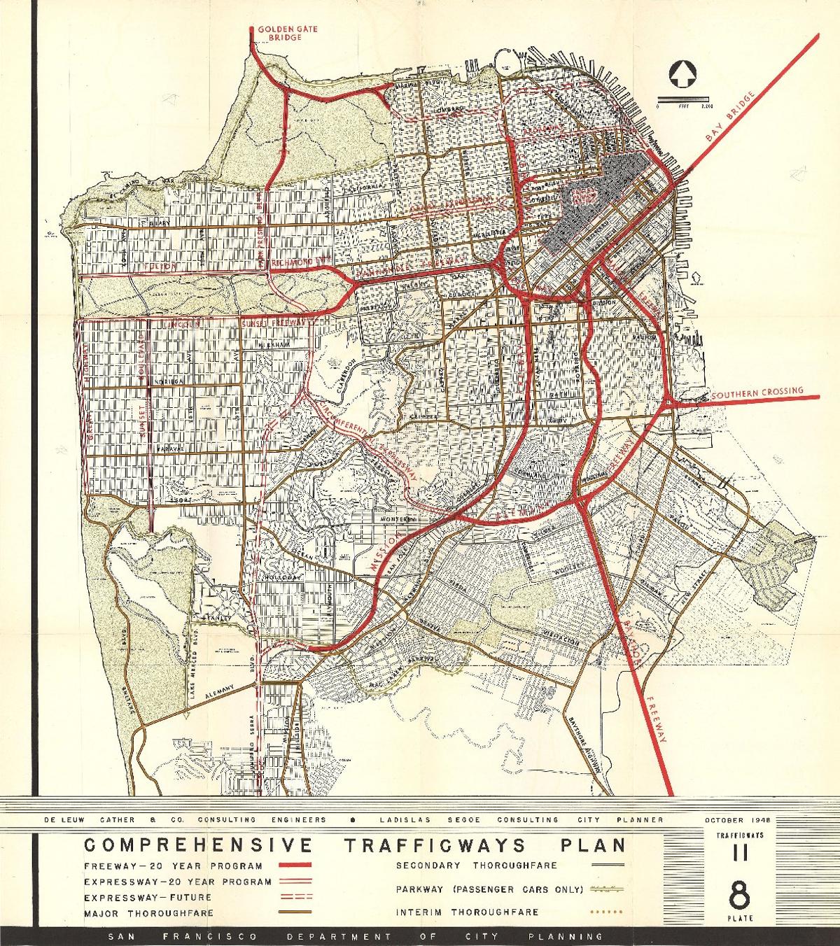
Understanding the present controversy requires a look back at the Central Freeway’s contentious history. Originating in 1930s WPA studies, the elevated highway was meant to encircle San Francisco’s core, a vision amplified by the 1956 Interstate Highway Act. Community opposition in the 1960s, the 1989 Loma Prieta earthquake, and three citywide ballot measures in the 1990s culminated in the removal of the freeway’s southern segment, reshaping the urban landscape into Octavia Boulevard and a truncated connector. These episodes illustrate how political will, seismic events, and public sentiment can dramatically alter infrastructure trajectories.
Today, the traffic mix has shifted. Pandemic‑induced remote work reduced peak commuter volumes, while on‑demand delivery services have surged, creating a more dispersed congestion pattern that circumvents the downtown core. This evolution challenges traditional traffic‑management models and underscores the need for adaptive planning that integrates multimodal options, real‑time data, and resilient design. The I‑80 closure, therefore, serves as a live case study in how legacy infrastructure can be retrofitted to meet modern mobility demands without triggering the gridlock of past “Carmageddon” scenarios.
What’s the Deal With I-80 and SF’s Central Freeway? Here’s a Brief History
Comments
Want to join the conversation?
Loading comments...