Airbus and Hisdesat Sign a Commercialisation Agreement for PAZ-2 Satellite Imagery
Companies Mentioned
Why It Matters
The enhanced SAR capabilities will boost Europe’s strategic intelligence assets while opening high‑value commercial opportunities in infrastructure monitoring and disaster response.
Key Takeaways
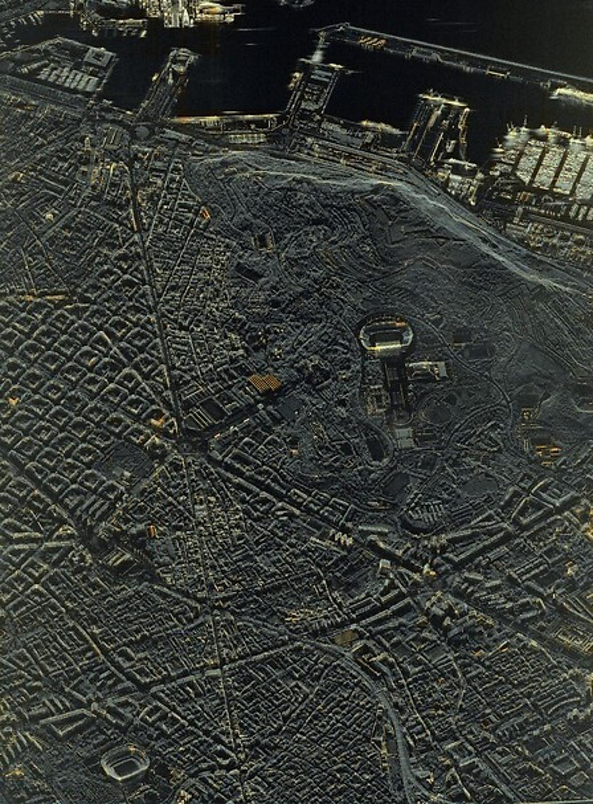
- •PAZ‑2 offers 10 cm SAR resolution
- •Daily coverage reaches 6.7 million km² per satellite
- •Five‑minute latency enables near‑real‑time imagery
- •Partnership expands commercial SAR market with TerraSAR‑X
- •First satellite entering service mid‑2031
Pulse Analysis
Synthetic Aperture Radar (SAR) is experiencing rapid adoption across defence, security and civil sectors, driven by its all‑weather, day‑and‑night imaging capability. Airbus Defence and Space’s alliance with Hisdesat positions Europe at the forefront of this trend, leveraging the PAZ‑2 constellation to deliver unprecedented image fidelity. By integrating advanced antenna designs and on‑board processing, PAZ‑2 achieves 10 cm ground resolution—comparable to optical systems—while covering 6.7 million square kilometres daily, a scale that rivals the combined output of many existing SAR fleets.
The technical leap of PAZ‑2 extends beyond resolution. A five‑minute latency pipeline transforms raw radar returns into actionable products almost instantly, a critical advantage for time‑sensitive missions such as border surveillance, rapid disaster assessment, and tactical battlefield intelligence. The 500 km swath width further ensures broad area monitoring with fewer passes, reducing revisit times and operational costs. These capabilities complement the existing TerraSAR‑X/TanDEM‑X constellation, creating a seamless European SAR network that can serve both national defence ministries and commercial clients seeking high‑precision terrain data.
From a business perspective, the commercialisation agreement unlocks new revenue streams for Airbus and Hisdesat, while reinforcing Spain’s strategic autonomy in space. The 65 % national participation underscores a policy shift toward domestic expertise and supply‑chain resilience. As global demand for high‑resolution SAR data surges—particularly in infrastructure monitoring, insurance underwriting, and climate‑risk modelling—the PAZ‑2 programme offers a competitive edge. Its mid‑2031 entry into service will likely catalyse further collaborations, stimulate ancillary services, and solidify Europe’s position in the lucrative SAR market.
Airbus and Hisdesat sign a commercialisation agreement for PAZ-2 satellite imagery
Comments
Want to join the conversation?
Loading comments...