Could One of Europe's Most Important Wetlands Really Vanish? Satellites Show It May Happen in Our Lifetime
Why It Matters
The wetland’s collapse would erode critical biodiversity corridors and diminish natural flood mitigation across Europe and Africa, underscoring urgent water‑resource governance. The satellite‑ML approach offers policymakers a real‑time, cost‑effective means to protect similar ecosystems worldwide.
Key Takeaways
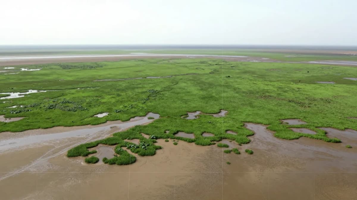
- •Sentinel‑2 data shows Doñana wetland shrinking since 2005.
- •Projected drying could occur within 45‑175 years without intervention.
- •Groundwater extraction for agriculture accelerates marsh water loss.
- •Wetland loss threatens migratory bird routes across Europe‑Africa.
- •Scalable satellite‑ML method can guide water management elsewhere.
Pulse Analysis
Remote‑sensing technology has transformed how scientists track fragile ecosystems. ESA’s Sentinel‑2 constellation delivers high‑resolution, multispectral imagery that, when paired with machine‑learning algorithms, can differentiate water, vegetation and dry soil with unprecedented accuracy. This capability enables continuous, large‑scale monitoring of wetlands—critical carbon sinks and biodiversity hotspots—without the logistical constraints of field surveys, providing decision‑makers with timely data to assess environmental change.
Doñana’s decline illustrates the convergence of climate stressors and human water demand. Warmer temperatures and a decade‑long drop in precipitation have reduced inflow, while intensive irrigation and illegal wells deplete the underlying aquifer that sustains the marsh. As surface water recedes, the habitat that supports millions of migratory birds and acts as a natural buffer against floods and droughts is compromised. The study’s projections of a possible tipping point within a human lifetime highlight the urgency of integrated climate‑water policies.
The broader implication is a blueprint for proactive wetland stewardship. By automating water‑extent detection, the Sentinel‑2/ML framework can be deployed across Europe’s coastal and inland wetlands, informing groundwater regulation, restoration projects, and climate‑adaptation strategies. Policymakers can leverage these insights to enforce well closures, promote sustainable agriculture, and allocate resources for habitat rehabilitation, thereby preserving ecosystem services that protect communities and economies from extreme weather events.
Could one of Europe's most important wetlands really vanish? Satellites show it may happen in our lifetime
Comments
Want to join the conversation?
Loading comments...