
Video•Mar 10, 2026
Why Are Hurricanes Scared of South America?
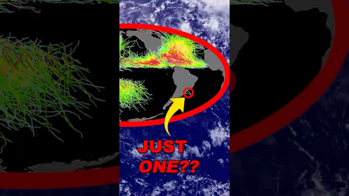
The video examines a comprehensive map of tropical cyclones from 1851 to 2010, using it to explain why hurricanes rarely form or travel near South America. It highlights the Pacific’s warm, extensive ocean as the planet’s most prolific hurricane‑fueling region and describes the typical westward track of storms before they encounter mid‑latitude westerlies that steer them eastward. Key insights include the dominant role of warm water, the prevailing easterly trade winds that push storms west, and the dramatic shift to westerly flow in higher latitudes that causes recurvature. The narration notes that about 85% of major Atlantic hurricanes trace back to a narrow “hurricane factory” off West Africa, while the equatorial zone remains cyclone‑free because the Coriolis effect—and thus the necessary spin—vanishes at the equator. Illustrative examples feature NASA’s twin cyclones, Asani and Kareem, forming just north and south of the equator and spinning in opposite directions, underscoring the Coriolis constraint. The video also cites the lone South Atlantic storm, Hurricane Katarina in 2004, which overcame the region’s typical cool Peru Current and persistent wind shear to make landfall in Brazil. Understanding these geographic and atmospheric barriers clarifies regional risk profiles, improves forecasting accuracy, and informs climate‑change models that predict shifts in hurricane behavior and potential exposure for coastal economies.
By PBS Terra

Video•Mar 5, 2026
The Hidden Danger of the Northern Lights
The video explores the hidden threat posed by the Northern Lights, focusing on the GNEISS mission’s rocket launches from Fairbanks, Alaska, designed to pierce the auroral zone and capture real‑time data on space weather. By sending instrument‑laden rockets up to...
By PBS Terra