TrailPrint3D Converts GPS Data Into 3D Printable Terrain Models
Key Takeaways
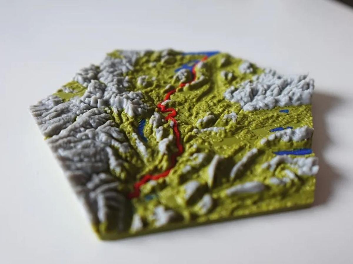
- •Blender plugin converts GPX tracks into printable 3D terrain
- •Supports square, circular, hex, and custom map shapes
- •Premium tier adds multi‑track and tiled map capabilities
- •All processing occurs locally, no cloud dependency
Pulse Analysis
The convergence of 3‑D printing and geographic data is reshaping how hikers memorialize their adventures. While traditional photo books capture visual memories, printable topographic models add a tactile dimension that appeals to collectors and makers alike. TrailPrint3D leverages the ubiquity of GPX files—generated by smartphones, watches, and dedicated GPS units—to transform raw coordinate streams into solid relief maps. This approach taps into the broader maker movement, where open‑source tools and affordable desktop printers enable small‑scale production of bespoke artifacts without industrial overhead.
Technically, TrailPrint3D distinguishes itself by embedding directly into Blender, the industry‑standard open‑source 3‑D suite. Users benefit from Blender’s robust mesh generation, material handling, and cross‑platform stability, while the plugin automates terrain extrusion, color mapping, and frame creation. Because all calculations run on the user’s workstation, sensitive location data never leaves the device, addressing privacy concerns that cloud‑based services often raise. The modular design also allows creators to experiment with shape presets—square, circular, hexagonal—or craft custom outlines, expanding artistic possibilities beyond conventional map formats.
From a commercial perspective, the ability to produce printable terrain models opens new revenue channels for outdoor retailers, guide services, and tourism boards. Premium features such as multi‑track overlays and tiled maps enable detailed representations of multi‑day treks or regional trail networks, which can be packaged as limited‑edition souvenirs or educational tools. Moreover, the local‑only workflow reduces operational costs and simplifies licensing, making it attractive for small businesses seeking to add a differentiated product line. As consumer demand for personalized, experiential memorabilia grows, tools like TrailPrint3D are poised to become a niche yet profitable segment of the 3‑D printing market.
TrailPrint3D Converts GPS Data Into 3D Printable Terrain Models
Comments
Want to join the conversation?