Federal Courts Use GIS to Improve Security, Visitor Experience
Why It Matters
A centralized GIS‑driven security framework shortens response times and builds public confidence, while virtual tours reduce on‑site confusion and enhance staff readiness—benefits that can be replicated across other federal agencies.
Key Takeaways
- •GIS unifies disparate court security and incident management tools
- •Virtual walkthroughs train staff on safety procedures remotely
- •Integrated platform enhances visitor navigation and experience
- •Federal courts set precedent for tech‑driven security modernization
Pulse Analysis
Geographic information systems have moved beyond mapping to become a cornerstone of public‑sector risk management. Federal agencies such as the Department of Homeland Security and the Federal Emergency Management Agency have long leveraged GIS for threat modeling, asset tracking, and real‑time situational awareness. By visualizing spatial data, these organizations can pinpoint vulnerabilities, allocate resources efficiently, and coordinate multi‑agency responses during emergencies. The broader adoption of GIS signals a shift toward data‑centric security strategies that prioritize interoperability and predictive analytics.
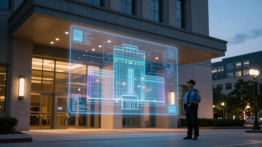
Within the judiciary, the Administrative Office of the Courts is translating that trend into a concrete security overhaul. The agency’s new GIS platform consolidates previously siloed alarm systems, camera networks, and access‑control databases into a single, map‑based interface. This integration enables incident commanders to view live alerts on a courthouse floor plan, dispatch responders faster, and generate after‑action reports with precise geolocation. Additionally, the virtual walkthrough feature lets staff rehearse evacuation routes and equipment usage without disrupting daily operations, while visitors benefit from interactive, pre‑visit tours that reduce confusion and improve overall satisfaction.
The implications extend well beyond the bench. By demonstrating how GIS can simultaneously tighten security and enhance user experience, the federal courts provide a replicable model for other government entities seeking modernization. Private‑sector vendors are likely to see increased demand for GIS‑enabled security solutions, while policymakers may consider funding incentives to accelerate similar projects across the public sphere. As spatial analytics continue to mature, the convergence of safety, efficiency, and citizen engagement will become a defining characteristic of next‑generation government operations.
Federal Courts Use GIS to Improve Security, Visitor Experience
Comments
Want to join the conversation?
Loading comments...