GeoComm Teams with Unknot.id to Deploy Public‑Safety‑Grade Indoor Location Intelligence
Why It Matters
Indoor location intelligence addresses a critical blind spot for first responders, who often rely on incomplete floor plans or manual scouting in emergencies. By delivering sub‑meter accuracy inside GPS‑denied structures, the GeoComm‑Unknot.id solution can reduce response times, lower the risk of misrouting, and improve overall public safety outcomes. For government agencies, the technology aligns with broader resilience initiatives and can justify budget allocations for modernizing emergency operations centers. Beyond public safety, the partnership illustrates how GovTech firms are converging on integrated, AI‑driven platforms that serve both the public and private sectors. The ability to overlay real‑time indoor positioning on dynamic maps creates new data streams for analytics, asset management, and crowd control, potentially reshaping procurement strategies across municipalities, transportation authorities, and large enterprises.
Key Takeaways
- •GeoComm and Unknot.id announced a partnership on April 14, 2026 to embed Fuse AI™ indoor positioning into GeoComm's mapping suite.
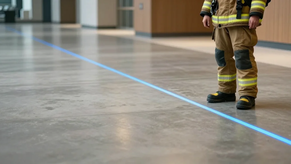
- •Fuse AI™ uses sensor fusion and AI to deliver real‑time sub‑meter accuracy in multi‑floor, GPS‑denied environments.
- •The joint solution targets public‑safety agencies, airports, healthcare systems, transportation hubs, and large enterprise campuses.
- •Quotes from TJ Kennedy (GeoComm) and Dr. Devu Shila (Unknot.id) emphasize faster response times and enhanced situational awareness.
- •Pilot deployments will begin in 2026, with broader rollout planned for later in the year.
Pulse Analysis
The GeoComm‑Unknot.id alliance reflects a broader maturation of GovTech where data integration and AI are becoming the default architecture for public‑safety solutions. Historically, indoor positioning has been fragmented—vendors offered either mapping or sensor‑based tracking, but rarely both in a seamless package. By marrying GeoComm's established mapping credibility with Unknot.id's AI‑driven sensor fusion, the partnership creates a defensible moat: customers receive a single vendor relationship, reduced integration risk, and a unified data model that can be extended to analytics and predictive alerts.
From a market perspective, the move could accelerate consolidation in the indoor‑location space. Larger players like Esri and HERE have already begun acquiring niche firms to fill indoor gaps, but the GeoComm‑Unknot.id model demonstrates that strategic partnerships can achieve similar outcomes without full acquisition. This may encourage other mid‑size GovTech firms to seek complementary alliances rather than pursue costly M&A, preserving capital while still delivering end‑to‑end solutions.
Looking ahead, the real test will be adoption velocity within government procurement cycles, which are traditionally slow and risk‑averse. If pilot projects can quantify reductions in response time—say, a 15‑20% improvement in fire‑department dispatches—budget committees may fast‑track broader deployments. Moreover, the data generated by these systems could feed into city‑wide situational‑awareness platforms, creating network effects that amplify the partnership's value beyond the initial use cases. In short, the collaboration not only fills a technical gap but also sets a template for how GovTech firms can co‑innovate to meet the evolving demands of public safety and enterprise resilience.
GeoComm Teams with Unknot.id to Deploy Public‑Safety‑Grade Indoor Location Intelligence
Comments
Want to join the conversation?
Loading comments...