New App in MO to Track Flood and Drought Conditions in Real Time
Why It Matters
Real‑time hydrologic data enhances agricultural planning and emergency preparedness, reducing economic losses from extreme weather events. The app positions Missouri as a leader in state‑level water‑resource digitalization.
Key Takeaways
- •MOHIC app delivers real‑time flood and drought data
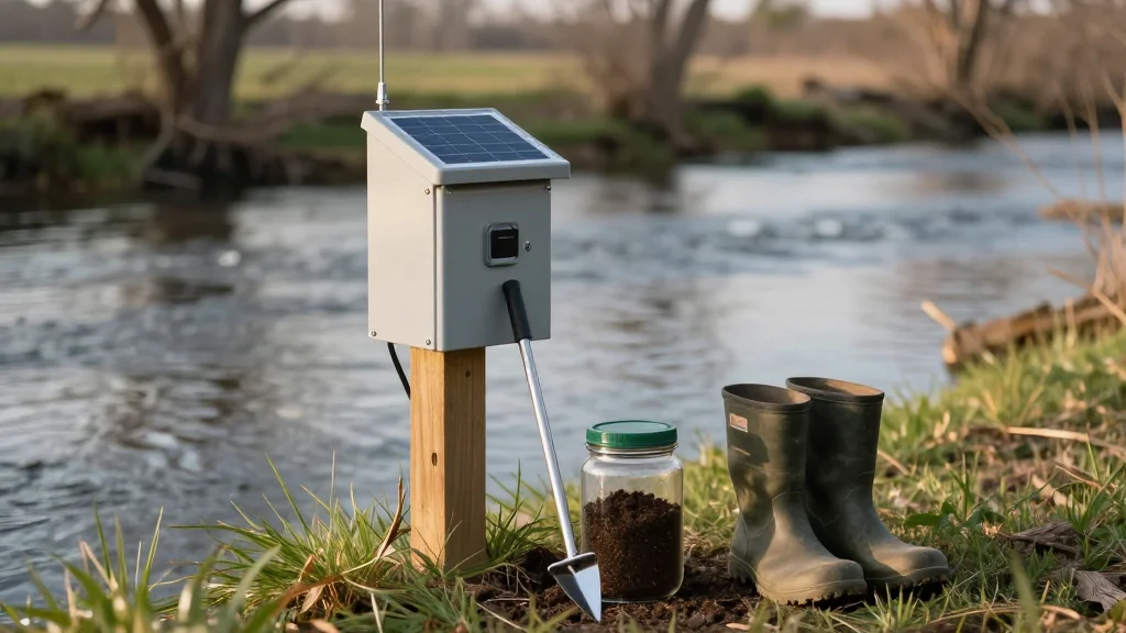
- •Integrates stream gauges and soil‑moisture sensor networks
- •Provides localized alerts for at‑risk communities
- •Supports farmers' irrigation planning and risk management
- •Accessible via free mobile download from Missouri DNR
Pulse Analysis
Missouri’s agricultural economy and densely populated river valleys have long grappled with the volatility of water availability. Seasonal droughts can cripple crop yields, while sudden floods threaten infrastructure and lives. By centralizing sensor data into a single mobile interface, the MOHIC app addresses a critical information gap, offering stakeholders a continuous pulse on hydrologic conditions that were previously siloed across agencies and research institutions.
The app’s architecture pulls from over 200 stream gauges and dozens of soil‑moisture stations, updating readings at intervals as short as five minutes. Users can zoom into county‑level maps, compare historical trends, and set custom thresholds that trigger push notifications when flood risk escalates. For farmers, this translates into precise irrigation scheduling and the ability to pre‑emptively protect fields. Emergency managers gain a reliable, real‑time situational awareness tool that complements traditional forecasting, enabling faster evacuations and resource allocation.
Beyond immediate utility, the MOHIC platform exemplifies how state governments can leverage open data to foster resilience. Its success may inspire neighboring states to adopt similar sensor‑driven applications, creating a regional network of interoperable water‑monitoring systems. As climate change intensifies precipitation extremes, such digital infrastructure will become indispensable for risk mitigation, insurance underwriting, and long‑term water‑resource planning.
New app in MO to track flood and drought conditions in real time
Comments
Want to join the conversation?
Loading comments...