Why It Matters
A unified, AI‑enhanced radar network will close critical surveillance gaps, strengthening Taiwan’s maritime security and environmental resilience while supporting commercial and recreational marine activities.
Key Takeaways
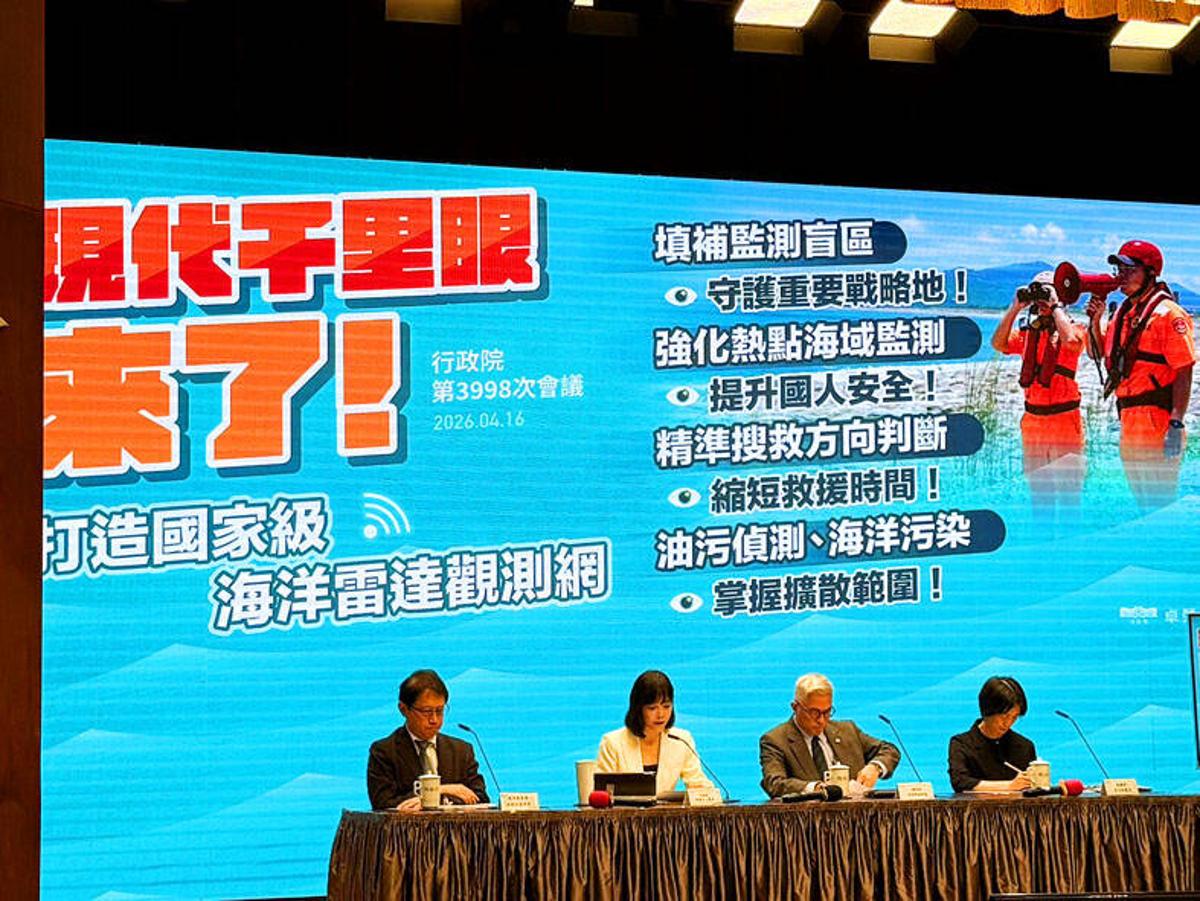
- •Integrate 57 heterogeneous marine radars across multiple Taiwanese agencies
- •Coverage expands to 210,000 km², up from 155,000 km² by 2028
- •AI will accelerate incident assessment, oil‑spill mapping, and rescue precision
- •Network targets blind spots in Taiwan Shoal, Luzon Strait, Pengjia Islet
- •Continuous all‑weather data will improve navigation safety and disaster response
Pulse Analysis
Taiwan’s decision to build a national ocean‑radar network reflects mounting pressure from regional geopolitical friction and a surge in marine incidents. By linking 57 existing radar installations—currently scattered across the Ocean Affairs Council, the Ministry of Transportation and Communications, the National Science and Technology Council, and the Ministry of National Defense—the government aims to close surveillance gaps around the Taiwan Shoal, Luzon Strait and Pengjia Islet. Premier Cho Jung‑tai emphasized that a unified data stream will provide continuous, all‑weather situational awareness, a capability that has been lacking in the island’s fragmented maritime monitoring architecture.
The new system leverages remote‑sensing radar, which captures sea‑surface currents, wave heights and wind patterns over a far larger footprint than traditional buoys or ship‑based observations. Expanding coverage from 155,000 km² to 210,000 km² by 2028, the network promises high‑resolution, real‑time imagery that can be fed directly into AI algorithms. These models will instantly assess oil‑spill extents, detect rip currents in popular recreation zones, and improve small‑target detection, thereby sharpening the precision of maritime rescue operations and environmental response.
For commercial shipping, fisheries and the burgeoning offshore oil‑and‑gas sector, the enhanced radar grid translates into safer navigation routes and more reliable weather forecasts, reducing costly delays. Tourists and local boaters benefit from timely public warnings about hazardous currents, while policymakers gain a robust decision‑support tool for disaster prevention. As Taiwan continues to position itself as a high‑tech maritime hub, the integration of AI‑driven analytics with a comprehensive radar network could become a model for other coastal nations seeking to modernize their marine‑monitoring infrastructure.
Ocean radar network plans outlined
Comments
Want to join the conversation?
Loading comments...