Yangtze River Digital Twin Cuts Flood Damage, Boosts Real‑Time Planning
Why It Matters
The deployment of a river‑scale digital twin demonstrates that PropTech solutions can move beyond building‑level analytics to address regional infrastructure challenges. By providing granular, real‑time flood forecasts, the system reduces economic losses, safeguards lives, and creates a data foundation for smarter land‑use planning. For investors and developers, the technology offers a new risk‑mitigation tool that can be monetized through insurance products, premium site selection and climate‑adaptation consulting. Moreover, the Yangtze model sets a precedent for public‑private data collaboration. As more municipalities digitize water‑resource networks, the resulting ecosystems could feed into global PropTech platforms, enabling cross‑border benchmarking of flood resilience and fostering a market for climate‑risk intelligence services.
Key Takeaways
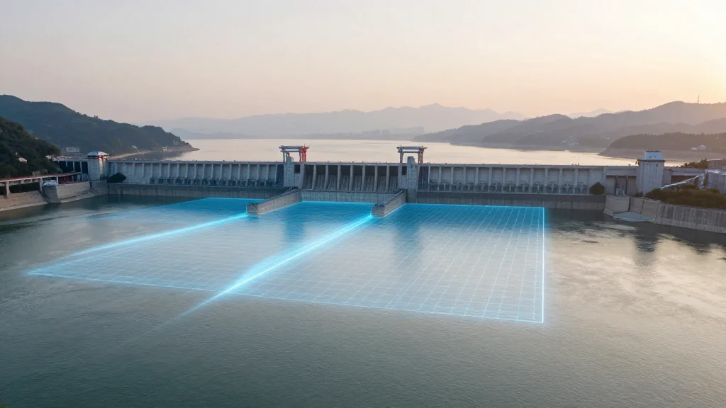
- •Digital twin of the Yangtze River and Three Gorges Dam went live in 2025, covering 706 polders and 2,430 km of dikes.
- •Early warnings on July 2, 2026 prompted alerts for 101 polders across six provinces.
- •Yang Min highlighted the twin’s ability to simulate past floods and predict real‑time water trends.
- •Li Anqiang noted the creation of a comprehensive database that enables advance notifications to local authorities.
- •A public API is planned for Q4 2026 to let private firms integrate flood data into their PropTech tools.
Pulse Analysis
The Yangtze digital twin is a watershed moment for the PropTech industry because it proves that large‑scale, geophysical twins can be operationalized for day‑to‑day risk management. Historically, digital twins have been confined to individual buildings or campuses; scaling to a 6,300‑km river system required integrating satellite imagery, IoT water‑level sensors, and high‑performance computing. This technical feat lowers the barrier for other regions to replicate the model, especially as sensor costs continue to fall.
From a market perspective, the twin creates a new data commodity. Real‑time flood forecasts are valuable not only to governments but also to insurers, lenders, and developers who need to price assets accurately. Expect a surge in startups offering API‑based flood‑risk services, similar to how weather APIs spawned a whole ecosystem of agricultural and logistics solutions. Traditional property insurers may partner with the commission to embed the twin’s outputs into underwriting models, potentially reshaping premium structures in flood‑prone markets.
Looking ahead, the twin’s success will likely accelerate the convergence of PropTech and climate‑tech. As climate change intensifies extreme weather, the demand for predictive, location‑specific risk analytics will grow. The Yangtze example provides a blueprint: combine authoritative public data, robust simulation engines, and open interfaces to empower private actors. The next challenge will be ensuring data privacy, model transparency, and equitable access so that the benefits of such technology are shared across both megacities and rural communities.
Yangtze River Digital Twin Cuts Flood Damage, Boosts Real‑Time Planning
Comments
Want to join the conversation?
Loading comments...