French Navy Deploys Deep-Sea Robot to Uncover 16th‑Century Shipwreck Artifacts
Why It Matters
The successful deployment of a deep‑sea ROV for archaeological recovery demonstrates that robotics can overcome the physical limits that have long constrained marine heritage research. By accessing sites beyond 8,000 feet, scholars can now investigate shipwrecks that were previously unreachable, potentially rewriting portions of maritime history. Moreover, the high‑resolution 3‑D models generated by photogrammetry provide a permanent digital record, enabling virtual study and preservation without further disturbance of fragile artifacts. Beyond academia, the mission highlights the commercial viability of specialized underwater robots. Companies like Travocean are proving that their platforms can serve both scientific and industrial clients, encouraging further funding and innovation in the sector. As governments prioritize cultural preservation and sustainable ocean use, robotics will likely become a cornerstone technology for monitoring, documenting, and protecting submerged heritage worldwide.
Key Takeaways
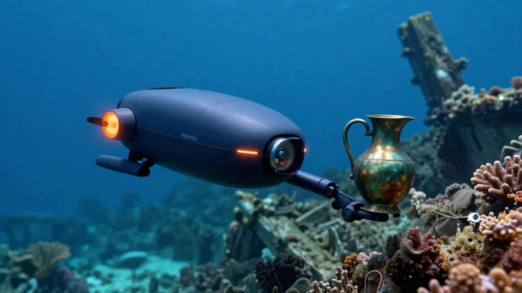
- •French Navy and DRASSM used a Travocean ROV rated for >13,000 ft to survey Camarat 4 at >8,200 ft depth
- •Mission captured 66,974 photos, producing the first full 3‑D model of a French‑jurisdiction deep‑sea wreck
- •Recovered three uniquely patterned ceramic pitchers and a historic plate from the 16th‑century ship
- •Wreck measures ~90 ft long, 22 ft wide; artifacts suggest Ligurian (Italian) origin
- •Data will be shared via an open‑access portal, enabling global scholarly collaboration
Pulse Analysis
The Camarat 4 operation illustrates a tipping point where deep‑sea robotics transition from niche research tools to mainstream assets for cultural heritage. Historically, maritime archaeology relied on diver‑led excavations limited to a few hundred meters of depth. The introduction of ROVs capable of operating at abyssal pressures not only expands the geographic scope but also reduces risk and cost, making large‑scale surveys financially feasible for state agencies.
From a market perspective, the success story validates the business case for firms like Travocean, which can now showcase a proven, high‑profile use case to attract defense, oil‑and‑gas, and scientific contracts. The data pipeline—ROV capture, photogrammetric processing, and open‑access distribution—creates a replicable workflow that other nations may adopt, potentially spurring a competitive race to map and claim deep‑sea cultural assets. This could lead to standardization of data formats and collaborative frameworks, much like the satellite‑imagery community has done.
Looking forward, the integration of AI‑driven image analysis could accelerate artifact identification, while advances in manipulator dexterity may enable the retrieval of more delicate items without damage. As climate change threatens underwater sites through rising temperatures and acidification, the ability to document and preserve these resources remotely becomes increasingly urgent. The Camarat 4 mission therefore not only enriches our understanding of 16th‑century trade but also sets a precedent for how robotics will safeguard humanity’s submerged past.
French Navy Deploys Deep-Sea Robot to Uncover 16th‑Century Shipwreck Artifacts
Comments
Want to join the conversation?
Loading comments...