London Borough of Harrow Builds Digital Twin Program One Drone Flight at a Time
Why It Matters
It shows local governments can achieve cost‑effective 3‑D asset management, improving service delivery and community engagement while keeping budgets modest.
Key Takeaways
- •$1,270 drone kick‑started Harrow’s digital twin.
- •$15,240 saved on a single roof inspection.
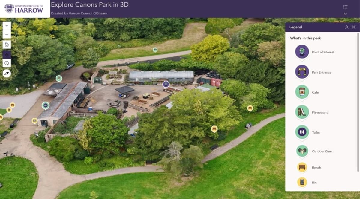
- •3‑D park models attracted one‑third of site visitors.
- •Cloud photogrammetry eliminated local server costs.
- •Small UAV program scalable pending staff training.
Pulse Analysis
Digital twins have moved from large‑scale corporate pilots to municipal tools, yet many local authorities balk at the perceived expense of UAV data collection. Harrow’s approach flips that narrative by starting with a hobby‑level drone, roughly $1,270, and building a layered model that combines a city‑wide low‑resolution mesh with high‑detail scans of priority assets. This incremental strategy sidesteps the need for a multi‑million‑dollar procurement, allowing the council to demonstrate tangible savings—such as the $15,240 roof‑survey win—early in the rollout.
The technical backbone hinges on Esri’s Site Scan for ArcGIS, a cloud‑native photogrammetry service that processes raw imagery without on‑premise servers. By uploading drone captures to the platform, Harrow eliminates hardware maintenance and reduces IT overhead, a critical factor for cash‑strapped councils. The resulting 3‑D models have already boosted citizen interaction: one‑third of visitors to the borough’s park pages explore the immersive models, signaling strong demand for visual, data‑rich public services. Moreover, the high‑resolution meshes aid operational challenges like illegal fly‑tipping, offering spatial context that 2‑D maps cannot provide.
Looking ahead, Harrow plans to enrich the twin with real‑time layers—traffic, weather, transit—and to explore predictive analytics for infrastructure planning. The primary hurdle remains staff capacity; expanding flight frequency will require training additional pilots. Nonetheless, the program offers a replicable blueprint for other local authorities: verify airspace, start small with affordable UAVs, and prove value before scaling. As municipalities seek smarter, data‑driven decision‑making, Harrow’s modest yet effective digital twin could become a template for cost‑conscious urban innovation.
London Borough of Harrow Builds Digital Twin Program One Drone Flight at a Time
Comments
Want to join the conversation?
Loading comments...