Researchers Are Combining Drones and AI to Make Removing Land Mines Faster and Safer
•March 5, 2026
0
Why It Matters
Accelerating demining saves lives and restores livelihoods in post‑conflict zones, while open datasets spur industry and humanitarian innovation worldwide.
Key Takeaways
- •Drone-mounted sensors cut survey time tenfold
- •Multisensor datasets enable AI model training and benchmarking
- •Uncertainty metrics improve safety for demining operators
- •Open datasets bridge academia, industry, humanitarian efforts
Pulse Analysis
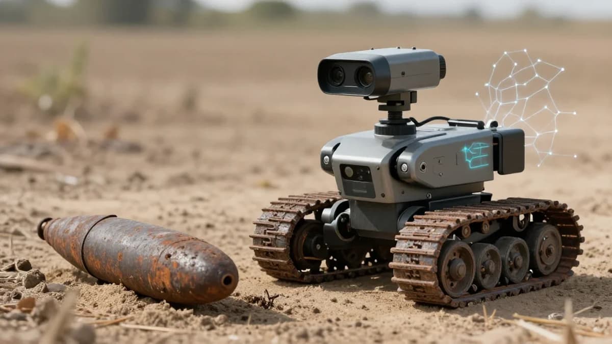
The world still lives with over 57 nations littered with antipersonnel mines, claiming nearly 2,000 lives in 2024 alone. Conventional demining—handheld metal detectors, ground‑penetrating radar, probing, and detection animals—struggles with mineral‑rich soils, plastic mines, and hazardous terrain, limiting speed and exposing personnel to danger. Recent advances in drone‑borne imaging and magnetic sensing promise to overcome these constraints, delivering ten‑times faster surveys while keeping humans out of the blast radius. Yet visual camouflage and variable lighting keep surface mines hidden from ordinary RGB cameras, prompting a shift toward multisensor platforms.
The RIT team, led by a Ph.D. student and Emmett Ientilucci, has assembled the first publicly available, georeferenced multisensor dataset covering hyperspectral, thermal, LiDAR, SAR, GPR, and magnetometer data collected over more than 140 inert mines in Oklahoma and Belgium. By releasing both raw sensor streams and precise ground‑truth coordinates, the project creates a benchmark for training AI models and comparing single‑sensor versus fused‑sensor approaches. A parallel line of research adds uncertainty estimation to AI predictions, allowing systems to flag low‑confidence detections and give deminers actionable risk metrics.
Open access to such comprehensive data lowers the barrier for startups, defense contractors, and NGOs to develop robust demining solutions, accelerating the transition from laboratory prototypes to field‑ready systems. Faster, AI‑driven surveys can shrink the time needed to clear contaminated zones, directly reducing civilian casualties and enabling displaced communities to resume agriculture and schooling. Policymakers and humanitarian agencies stand to benefit from standardized performance metrics, while the broader remote‑sensing community gains a testbed for multisensor fusion techniques applicable beyond mine clearance, from environmental monitoring to infrastructure inspection.
Researchers are combining drones and AI to make removing land mines faster and safer
0
Comments
Want to join the conversation?
Loading comments...