Researchers Develop Navigation System for Underground Rescue Teams
Why It Matters
Accurate, line‑of‑sight‑free positioning dramatically improves safety and coordination for rescue teams operating in collapsed tunnels, mines or subway stations, where traditional navigation fails. The technology could set a new standard for emergency response in confined, GPS‑denied environments.
Key Takeaways
- •UWB network provides sub‑meter localization for robots and rescuers
- •Robot maps environment, shares data with wearables via UWB tags
- •Factor‑graph optimization links past measurements to refine position accuracy
- •Prototype tested at University of Leoben, ready for real‑world deployment
- •Future plans include ruggedizing components and adding mini‑drones
Pulse Analysis
Underground emergencies—whether in mining shafts, subway tunnels or collapsed infrastructure—pose a unique navigation challenge. Conventional signals such as GPS, cellular or Wi‑Fi disappear, leaving rescue crews to rely on outdated schematics or risky manual mapping. The lack of reliable positioning hampers situational awareness, slows response times, and increases the likelihood of secondary accidents, such as falls or exposure to hazardous gases. As urban centers expand underground, the demand for robust, signal‑independent navigation solutions has become a critical safety priority.
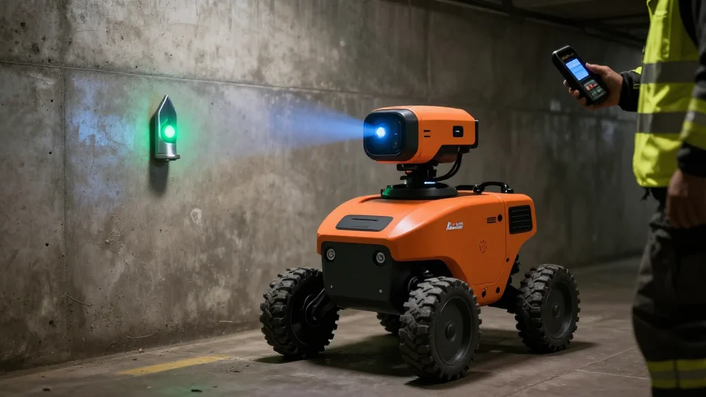
The NIKE MATE project addresses this gap by integrating a fleet of sensor‑rich robots with a purpose‑built ultra‑wideband (UWB) communication mesh. The lead robot scans the environment using laser, visual and wheel odometry sensors, generating a live 3‑D map. Wearable UWB tags on rescuers and strategically placed anchors transmit distance measurements, enabling the system to triangulate positions with better than one‑metre accuracy—even through smoke and debris. Advanced factor‑graph optimization reprocesses historic measurements, continuously refining the map as teams move, while AI‑driven motion analysis distinguishes walking, crawling or prone postures to further enhance situational awareness.
Beyond the immediate safety gains, the technology signals a broader shift toward autonomous, data‑centric emergency response. By eliminating dependence on external infrastructure, agencies can deploy the system in any subterranean scenario, from coal mines to subway construction sites. The research team’s roadmap includes ruggedizing components for harsh conditions and integrating mini‑drones to capture overhead perspectives, expanding the data envelope. As public‑private partnerships invest in resilient urban infrastructure, solutions like NIKE MATE are poised to become standard equipment, driving a new market for underground navigation and rescue robotics.
Researchers develop navigation system for underground rescue teams
Comments
Want to join the conversation?
Loading comments...