New NASA Graphic Captures Human Activity at Night
Why It Matters
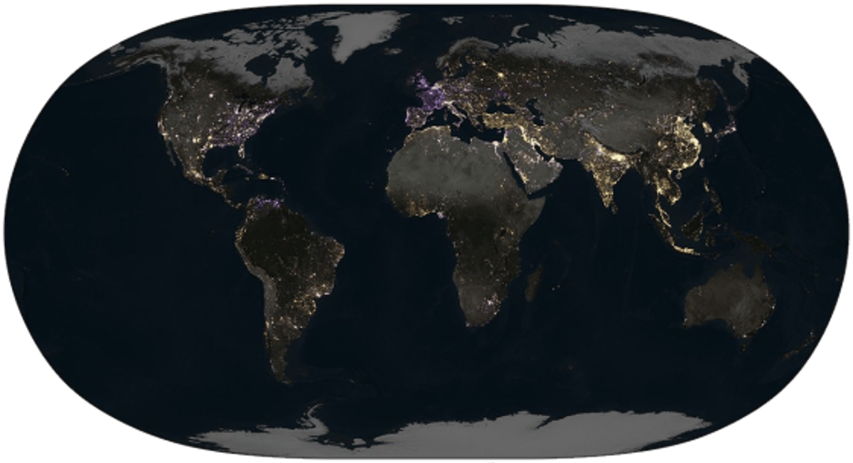
The map reveals shifting patterns of economic activity and energy consumption, offering governments and investors a novel metric for urban development, sustainability policies, and geopolitical impacts.
Key Takeaways
- •Global nighttime radiance rose 34% from 2014‑2022.
- •China and India showed the strongest light intensity growth.
- •U.S. East Coast and Europe experienced noticeable dimming.
- •Dimming linked to LED adoption and war‑driven energy cuts.
- •NASA’s Black Marble offers real‑time insight into human activity.
Pulse Analysis
The Black Marble initiative, launched by NASA’s Earth Science Division, fuses observations from the Suomi NPP, NOAA‑20 and the newly commissioned JPSS‑2 satellites. By correcting for cloud cover, terrain shading and atmospheric airglow, the project delivers a consistent, night‑time radiance product that rivals traditional daytime imaging for tracking human footprints. This capability is especially valuable for regions where ground‑based data are sparse, allowing analysts to monitor urban sprawl, infrastructure development, and even disaster impacts from space.
A recent study published in *Nature* leveraged the Black Marble dataset to quantify a 34 percent global increase in artificial light between 2014 and 2022. The gains were concentrated in fast‑growing economies such as China and India, where expanding megacities and industrial zones intensified nighttime illumination. Conversely, the East Coast of the United States and much of Europe showed a measurable dimming trend, driven by widespread LED retrofits, stricter lighting ordinances, and, in Europe’s case, reduced consumption during the energy crisis sparked by the Russo‑Ukrainian conflict. These divergent trajectories illustrate how policy choices and geopolitical events directly manifest in the night‑time light signature.
For policymakers and investors, the Black Marble map serves as a proxy for economic vitality, energy efficiency, and even carbon emissions. Planners can pinpoint emerging urban corridors, assess the effectiveness of lighting regulations, and gauge the resilience of power grids under stress. Commercial entities, from telecoms to real‑estate developers, are increasingly integrating night‑light analytics into site selection and market forecasting. As satellite constellations expand and data latency shrinks, the granularity and timeliness of such insights will only improve, cementing nighttime radiance as a critical indicator in the toolkit of modern decision‑makers.
New NASA Graphic Captures Human Activity at Night
Comments
Want to join the conversation?
Loading comments...