Curiosity Mars Rover: Sharpshooting on Mount Sharp
Why It Matters
The findings provide concrete evidence of Mars’ shifting climate, informing models of planetary habitability and guiding future exploration strategies. Understanding water’s historical presence is crucial for assessing the planet’s potential to have supported life.
Key Takeaways
- •Curiosity captured mud tracks on Mount Sharp on Sol 4928.
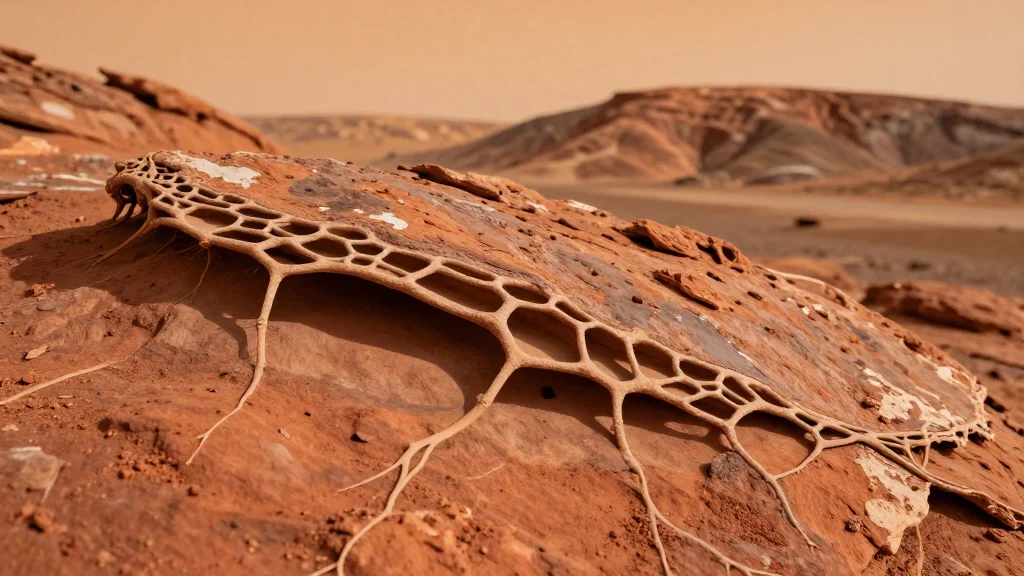
- •Boxwork structures suggest ancient water activity and climate shifts.
- •Each mountain layer records a distinct era of Mars’ drying climate.
- •Images reveal cracked mud and arid terrain as rover climbs higher.
- •Findings help decode Mars’ habitability timeline for future missions.
Pulse Analysis
The Curiosity rover, now in its 13th year on the Martian surface, has entered a pivotal phase of its Mount Sharp campaign. By leveraging its Navigation Cameras, the team obtained high‑resolution mosaics that showcase fresh mud footprints and a network of boxwork formations. These visual records not only enrich the rover’s geological archive but also serve as a benchmark for comparing earlier observations from the lower slopes, highlighting the instrument’s enduring capability to capture fine‑scale surface details.
Boxwork—intricate, honeycomb‑like mineral structures—has emerged as a key indicator of past aqueous environments. Their presence on the 5‑kilometer‑tall peak suggests that liquid water once percolated through sedimentary layers, solidifying into silica or carbonate frameworks that later resisted erosion. Coupled with the observed transition from wet‑laden mud cracks to increasingly arid strata, the data reinforce a narrative of a planet that gradually lost its surface water, interspersed with episodic wet phases that may have supported microbial life. Researchers are re‑evaluating climate models to incorporate these nuanced wet‑dry cycles, refining estimates of when and where habitable niches could have existed.
The implications extend beyond academic curiosity. As NASA and international partners plan the next wave of Mars missions—including sample‑return and crewed landings—the Mount Sharp findings help pinpoint strata that are most likely to preserve biosignatures. By mapping the chronology of water activity, mission designers can target drilling sites with higher scientific payoff while mitigating risks associated with unstable terrain. Ultimately, Curiosity’s latest images act as a geological road map, steering humanity toward the most promising chapters of Mars’ watery past.
Curiosity Mars Rover: Sharpshooting on Mount Sharp
Comments
Want to join the conversation?
Loading comments...