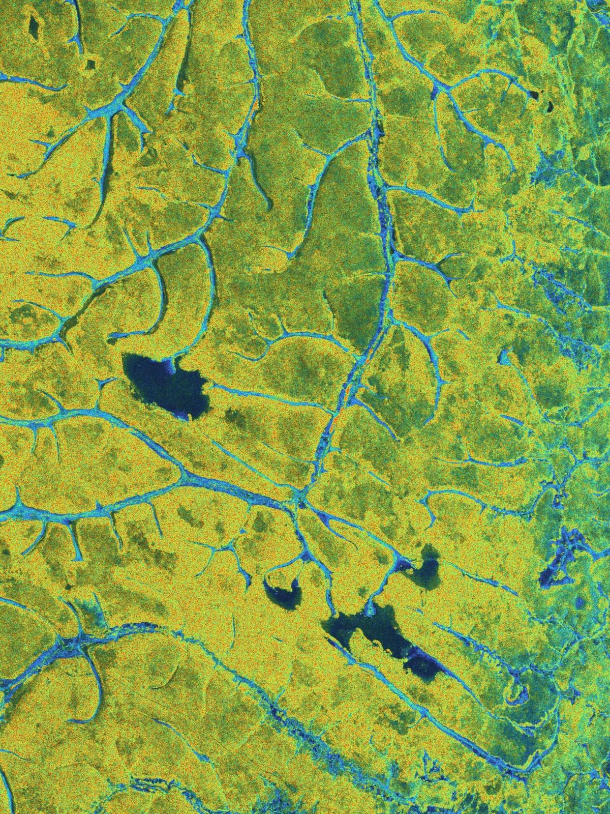
Stunning Images From Biomass Mark Its One Year in Orbit
Why It Matters
Open, high‑resolution biomass data improves climate‑model accuracy and supports policy decisions on carbon accounting, while the technology opens new remote‑sensing markets beyond forestry.
Key Takeaways
- •Biomass uses P‑band SAR to penetrate canopies, measuring woody biomass
- •First-year data now openly available to researchers worldwide via ESA portal
- •Images refine forest carbon stock estimates, strengthening climate change models
- •Mission also tracks ice‑sheet velocities and explores subsurface geology
- •ESA marked Biomass anniversary with striking global forest and Arctic views
Pulse Analysis
The Biomass satellite marks a milestone for Earth observation by deploying the first P‑band synthetic aperture radar (SAR) capable of penetrating dense forest canopies. Launched on 29 April 2025, the mission entered a commissioning phase that fine‑tuned its instruments before releasing data to the public in January 2026. By converting radar backscatter into estimates of woody biomass—trunks, branches, and stems—the satellite provides a direct proxy for carbon stored in forests, a metric that has long eluded scientists relying on optical imagery alone. The open‑access policy ensures that universities, NGOs, and commercial analysts can integrate these measurements into climate models and carbon‑credit frameworks without delay.
Early results already demonstrate Biomass’s transformative potential for climate science. Researchers have used the data to recalibrate forest carbon inventories across the Amazon, Congo Basin, and Southeast Asian rainforests, revealing both previously hidden carbon pools and rapid loss in vulnerable hotspots. The high‑resolution, all‑weather capability also enables continuous monitoring of forest response to droughts, fires, and logging, feeding more timely inputs into the Intergovernmental Panel on Climate Change (IPCC) assessments. By reducing uncertainty in carbon stock estimates, policymakers gain a sturdier foundation for emissions‑trading schemes and national reporting under the Paris Agreement.
Beyond forestry, Biomass’s polarimetric SAR images are proving valuable for glaciology and geology. The radar’s ability to detect surface motion has yielded precise ice‑sheet velocity maps in Greenland and Antarctica, informing sea‑level rise projections. In arid regions, subtle subsurface signatures are being explored for mineral exploration and groundwater mapping. As the satellite completes its first year, the broader remote‑sensing community anticipates a cascade of derivative applications, from commercial forest‑management tools to next‑generation Earth‑Explorer missions that will build on Biomass’s technological legacy. The data’s availability and versatility position Europe at the forefront of satellite‑based climate intelligence.
Stunning images from Biomass mark its one year in orbit
Comments
Want to join the conversation?
Loading comments...