This Canadian Crater Looks Like Marbled Meat | Space Photo of the Day for Jan. 6, 2026
•January 6, 2026
0
Companies Mentioned
Why It Matters
The image demonstrates how high‑resolution, multi‑spectral satellite data can monitor geological heritage and ecosystem health, informing both scientific research and conservation policy.
Key Takeaways
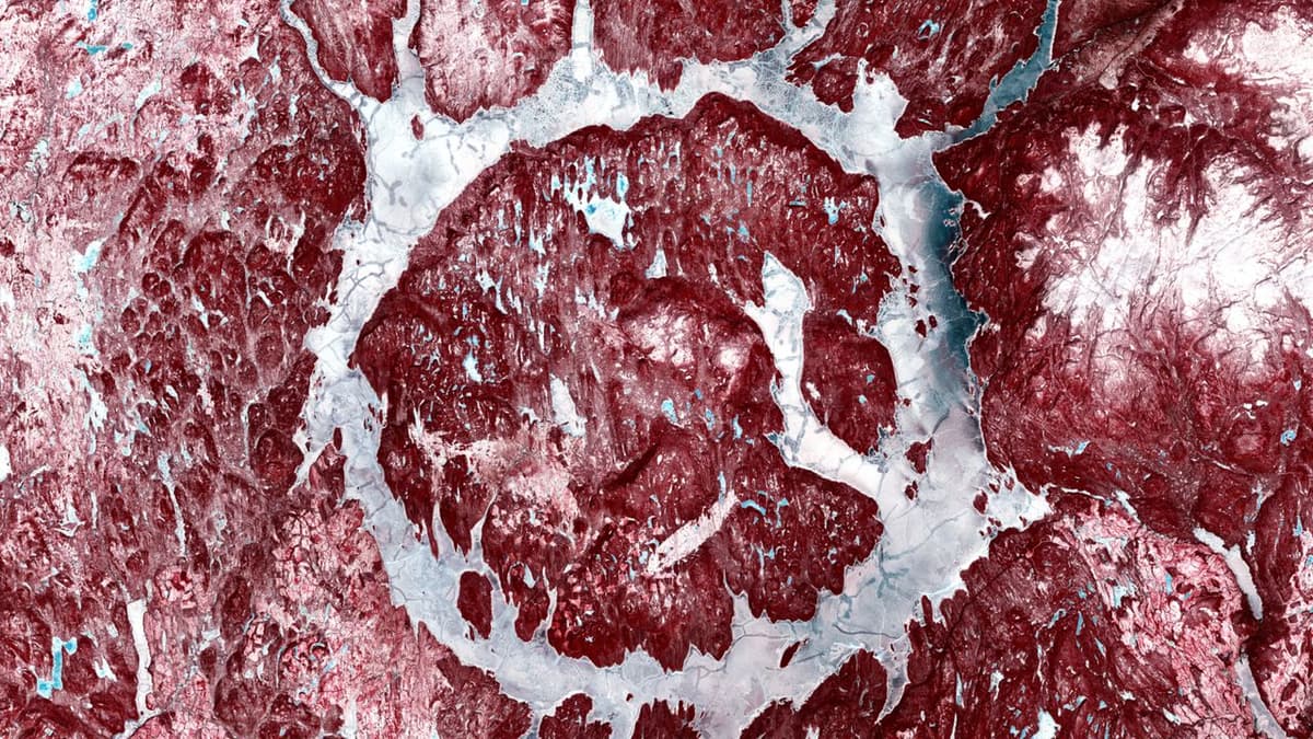
- •Manicouagan crater spans 72 km, formed 214 Myr ago
- •Sentinel‑2 captures 13 spectral bands, 10 m resolution
- •False‑color highlights vegetation, snow, water distinctly
- •Crater hosts UNESCO biosphere reserve ecosystems
- •Satellite imagery supports geological and environmental research
Pulse Analysis
The Sentinel‑2 constellation, part of the European Union’s Copernicus programme, continuously gathers imagery across 13 spectral bands, delivering 10‑meter spatial detail. This multi‑spectral capability enables analysts to differentiate surface materials that appear identical to the naked eye, such as distinguishing dense boreal forest from bare rock or snow from ice. By applying false‑color composites, scientists transform raw data into intuitive visualizations that highlight subtle environmental patterns, making remote sensing a powerful tool for land‑cover mapping, resource management, and disaster response.
Manicouagan crater, one of Earth’s most prominent impact structures, offers a unique natural laboratory for studying planetary geology. The 72‑kilometre annular lake, encircling René‑Levasseur Island, preserves the concentric rings of an ancient asteroid collision that reshaped the Canadian Shield. Its age—approximately 214 million years—places the event in the Late Triassic, a period of significant biological turnover. Modern satellite observations reveal the crater’s enduring topography and the surrounding boreal forest, providing insights into how such cataclysmic events influence long‑term landscape evolution and sedimentary processes.
Beyond its geological allure, the crater’s inclusion in a UNESCO biosphere reserve underscores its ecological importance. The high‑resolution, multi‑spectral data capture variations in vegetation health, snow cover duration, and water quality, informing climate‑change assessments and biodiversity monitoring. Researchers can track shifts in forest composition, permafrost melt, and lake dynamics over time, supporting adaptive management strategies. As satellite technology advances, the integration of Sentinel‑2 imagery with emerging platforms promises even finer temporal and spatial analyses, reinforcing the role of space‑based observation in safeguarding both Earth’s geological heritage and its living ecosystems.
This Canadian crater looks like marbled meat | Space photo of the day for Jan. 6, 2026
0
Comments
Want to join the conversation?
Loading comments...