
Key Takeaways
- •Thermocline: rapid temperature drop below surface mixed layer.
- •Strongest in tropical and temperate summer; weak in polar regions.
- •Halocline and pycnocline reflect salinity and combined density gradients.
- •Layered density drives vertical mixing, influencing currents and climate.
- •NASA visualizations show distinct current patterns across ocean layers.
Pulse Analysis
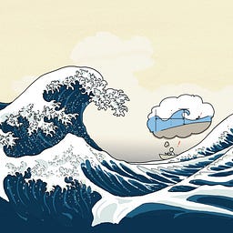
The thermocline represents a fundamental physical boundary in the world’s oceans, where water temperature can plunge several degrees within a few metres of depth. This abrupt gradient arises because solar heating warms the surface mixed layer, while deeper water remains insulated from direct sunlight. Seasonal heating amplifies the thermocline in low‑latitude regions, creating a pronounced barrier that limits vertical mixing. In contrast, polar waters experience a muted thermocline due to the uniformly cold surface, which has implications for heat transport and sea‑ice formation.
Beyond temperature, salinity variations generate haloclines, and together with the thermocline they form a pycnocline—a density gradient that governs buoyancy-driven flows. Freshwater influx from melting Greenland ice sheets, for example, creates a low‑density surface lens that can suppress deep‑water sinking, altering the Atlantic Meridional Overturning Circulation. These layered structures channel water masses along distinct pathways, shaping global thermohaline circulation and influencing regional climate patterns. Researchers leverage satellite data and in‑situ profiling to map these layers, improving predictions of heat uptake and carbon sequestration.
For industry and policymakers, the practical stakes are clear. Fisheries depend on nutrient upwelling that often occurs at thermocline edges, while naval operations must account for sound‑speed variations caused by temperature stratification. Climate models that accurately represent thermocline dynamics produce more reliable sea‑level rise forecasts. Educational tools like NASA’s visualizations and Sketchplanations’ illustrated videos make these complex concepts accessible, fostering a better‑informed public and supporting data‑driven decision‑making across marine sectors.
Thermocline
Comments
Want to join the conversation?