A Search Engine for the Planet Opens to the Public
Why It Matters
The tool democratizes powerful geospatial analytics, enabling faster, lower‑cost investigations of deforestation, illegal mining, and other environmental threats. Its accessibility could accelerate accountability and policy action across the sustainability sector.
Key Takeaways
- •Earth Index lets anyone search satellite images by visual similarity
- •Open tier provides free global access to core geospatial AI tools
- •Early users uncovered illegal mining, airstrips, and methane hotspots
- •Lowered technical barrier expands environmental monitoring to NGOs and journalists
Pulse Analysis
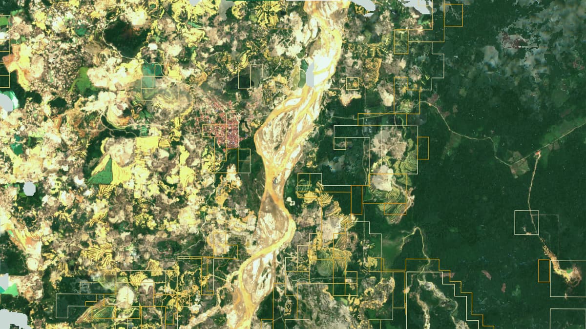
The release of Earth Index marks the first time a foundation‑model‑driven search engine for satellite imagery is openly available to the public. Built by the nonprofit Earth Genome, the platform leverages massive archives of publicly sourced Earth observation data to translate raw pixels into searchable visual patterns. Until now, extracting such insights required custom machine‑learning pipelines and costly cloud compute, limiting use to well‑funded research labs or government agencies. By packaging the technology behind a simple web interface, Earth Index lowers the entry barrier and turns the planet’s visual record into a searchable database.
Early adopters have already demonstrated the platform’s investigative power. Mongabay journalists used Earth Index to pinpoint previously undocumented narcotrafficking airstrips in the Peruvian Amazon, while conservation groups mapped illegal gold mining across the Brazilian rainforest and identified methane‑rich cattle operations in California’s Central Valley. The tool’s ability to generate training labels from a single reference image accelerates dataset creation, turning weeks‑long projects into multi‑day workflows. By democratizing access, NGOs, academic researchers, and even local community groups can now conduct high‑resolution environmental audits without hiring specialized data scientists.
Despite its promise, Earth Index is not a panacea. The underlying imagery is limited to moderate‑resolution, publicly available satellites, which constrains real‑time monitoring and fine‑scale detection. False positives remain a risk, requiring human verification before policy action. Moreover, broader accessibility raises governance questions about potential misuse for commercial espionage or unauthorized surveillance. Earth Genome’s tiered model—free core features with paid “Deep Search” upgrades—aims to fund continued development while preserving free access for high‑impact users. As more stakeholders adopt the tool, its true environmental impact will hinge on responsible usage and collaborative oversight.
A search engine for the planet opens to the public
Comments
Want to join the conversation?
Loading comments...