AI System GOFLOW Generates Hourly Global Ocean‑Current Maps From Satellite Thermal Images
Why It Matters
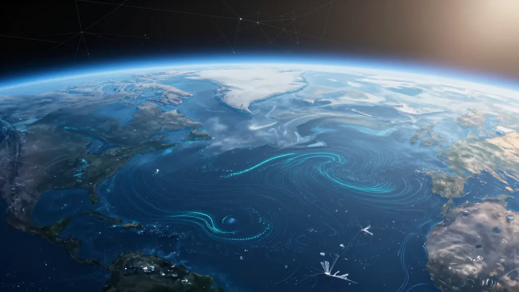
Ocean currents are the planet’s conveyor belt, moving heat, carbon and nutrients across vast distances. By delivering hourly, high‑resolution current maps, GOFLOW equips scientists with the granularity needed to study rapid mixing events that drive marine ecosystems and influence climate feedback loops. The ability to monitor these dynamics in near real‑time also strengthens societal resilience, enabling faster, data‑driven decisions during maritime emergencies. Moreover, GOFLOW exemplifies how artificial intelligence can unlock hidden value from legacy satellite assets. Rather than launching new sensors, the method repurposes weather‑satellite thermal data, dramatically lowering the barrier to entry for advanced ocean observation. This paradigm could inspire similar AI‑driven reinterpretations of other existing Earth‑observing datasets, accelerating progress across the geosciences.
Key Takeaways
- •GOFLOW converts GOES‑East thermal images into hourly global ocean‑current maps
- •Deep‑learning model trained on high‑resolution ocean circulation simulations
- •Captures sub‑10 km features and rapid mixing events missed by traditional altimetry
- •Supported by grants from the Office of Naval Research, NASA and the European Research Council
- •Potential to improve climate models, weather forecasts, and emergency response operations
Pulse Analysis
For decades, oceanographers have depended on satellite altimetry and sparse in‑situ measurements to infer surface currents. While altimetry provides accurate geostrophic flow, its temporal resolution—typically a revisit every ten days—fails to capture the fast‑evolving, mesoscale dynamics that drive vertical mixing and biogeochemical transport. GOFLOW flips this paradigm by exploiting the high‑frequency thermal imaging already available from geostationary weather satellites. The approach mirrors a broader trend in Earth science: using AI to extract physical signals from data streams originally intended for unrelated purposes.
Historically, attempts to infer currents from sea‑surface temperature have been hampered by the indirect nature of the signal and the difficulty of disentangling atmospheric effects. GOFLOW’s success hinges on a two‑pronged strategy: a physics‑based simulation that supplies a ground‑truth training set, and a neural network capable of learning subtle pattern deformations. This synergy reduces reliance on empirical heuristics and yields a model that generalizes across ocean basins. As other research groups adopt similar simulation‑driven AI pipelines, we can expect a rapid expansion of high‑resolution, near‑real‑time ocean products.
Operational adoption will be the next litmus test. NOAA and other agencies have already begun integrating AI‑derived products into their workflows, but scaling a model that processes terabytes of satellite data daily poses computational and validation challenges. If GOFLOW can demonstrate consistent performance across seasons and under varying cloud cover, it could become a staple of the global ocean observing system, complementing existing satellite and buoy networks. In the longer term, the methodology may be extended to other variables—such as salinity or chlorophyll—further enriching our understanding of the ocean’s role in Earth’s climate system.
AI System GOFLOW Generates Hourly Global Ocean‑Current Maps from Satellite Thermal Images
Comments
Want to join the conversation?
Loading comments...