AI Turns Weather Satellites Into High‑Resolution Ocean Current Maps
Why It Matters
Accurate, high‑frequency observations of ocean currents are essential for climate prediction, carbon‑cycle accounting, and marine ecosystem management. By repurposing existing weather satellites, GOFLOW provides a scalable, low‑cost solution that can be rapidly deployed worldwide, addressing a critical data deficiency that has limited the fidelity of climate models for decades. The method also offers immediate operational benefits, enabling faster response to maritime emergencies and more precise navigation for commercial shipping. Beyond the scientific gains, GOFLOW exemplifies a broader trend of leveraging AI to extract new value from legacy Earth‑observation assets. This approach could inspire similar innovations across other domains—such as using atmospheric sensors to monitor land‑surface processes—thereby amplifying the return on past investments in satellite infrastructure.
Key Takeaways
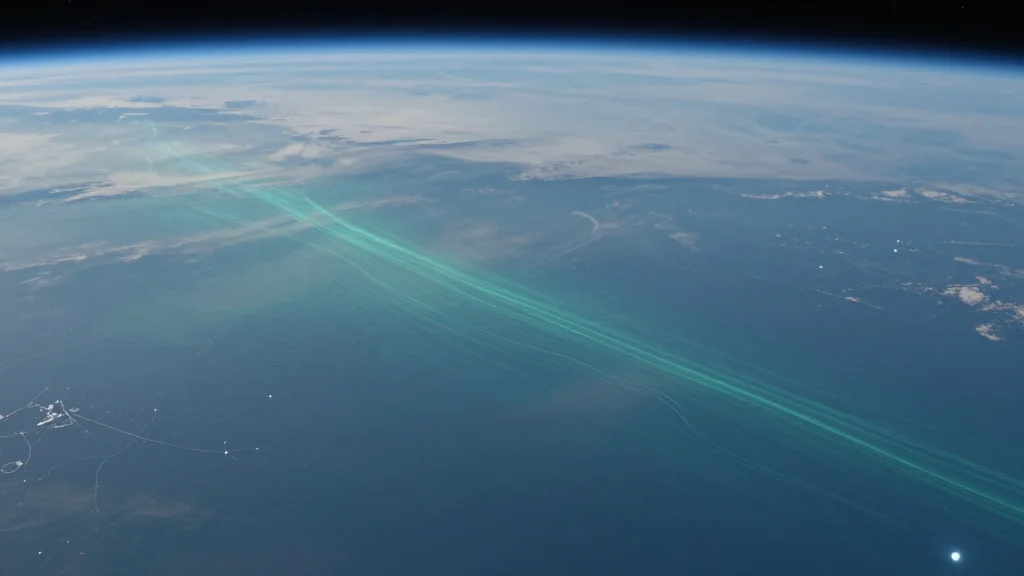
- •GOFLOW uses AI to turn GOES‑East thermal images into ocean‑current maps every five minutes
- •Captures currents as small as 10 km, far finer than the 10‑day revisit of traditional altimeters
- •Developed by UC San Diego’s Scripps Institution of Oceanography and UCLA, published in Nature Geoscience
- •Funded by the Office of Naval Research, NASA, and the European Research Council
- •A public data portal is planned for early 2027, enabling real‑time access for climate and maritime users
Pulse Analysis
GOFLOW arrives at a moment when climate science is hungry for granular ocean data to close the gap between atmospheric forecasts and oceanic reality. Historically, the ocean has been the weakest link in Earth‑system models because of sparse observations; satellite altimetry, while valuable, offers only coarse temporal resolution. By harnessing the high‑frequency thermal imaging already used for weather prediction, GOFLOW sidesteps the need for costly new satellite missions, delivering a quantum leap in data density at a fraction of the expense.
The technique also signals a strategic shift in how research agencies allocate resources. Funding from both defense (ONR) and civilian (NASA, ERC) sources reflects a recognition that ocean monitoring serves dual purposes: national security and climate stewardship. As more agencies adopt AI‑driven reinterpretations of legacy data, we can expect a cascade of similar breakthroughs—potentially turning microwave, lidar, or even radar datasets into new climate observables. This could accelerate the development of integrated, real‑time Earth‑system monitoring platforms that blend atmospheric, oceanic, and land‑surface information.
Looking forward, the real test for GOFLOW will be its integration into operational forecasting pipelines and its validation against independent measurements such as drifters and gliders. If the method proves robust, it could become a standard component of the next generation of climate models, reducing uncertainty in projections of sea‑level rise and extreme weather. Moreover, the democratization of high‑resolution ocean data may level the playing field for smaller research groups, fostering a more collaborative and data‑rich scientific community.
AI Turns Weather Satellites into High‑Resolution Ocean Current Maps
Comments
Want to join the conversation?
Loading comments...