Braving the Arctic for Upcoming Polar-Focused Satellites
Why It Matters
Accurate sea‑ice observations are critical for tracking climate change, informing EU environmental policy, and supporting global weather and navigation services. The campaign’s validation work reduces uncertainty in the upcoming satellites, ensuring reliable data for scientists, insurers, and commercial operators.
Key Takeaways
- •ESA testing CIMR, CRISTAL, ROSE‑L on Arctic sea ice
- •Six‑week campaign gathers ground, airborne, satellite data simultaneously
- •Measurements target snow depth, ice thickness, surface roughness
- •Field data will calibrate algorithms before satellite launch
- •Campaign builds on MOSAiC experiment’s multidisciplinary approach
Pulse Analysis
The rapid loss of Arctic sea ice has sharpened the demand for high‑resolution, trustworthy observations. Europe’s Copernicus programme is answering that call with three new Sentinel‑expansion satellites—CIMR, a microwave radiometer, CRISTAL, an L‑band altimeter, and ROSE‑L, a radar system—each designed to capture distinct ice characteristics. By diversifying sensing techniques, ESA hopes to fill critical data gaps in snow depth, ice thickness, and surface roughness, variables that are notoriously difficult to retrieve from space alone.
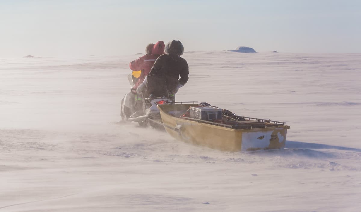
Validating these sophisticated sensors requires more than laboratory tests. The six‑week Copernicus Expansion Missions Sea Ice Experiment places scientists and engineers directly on the frozen tundra of Canada’s Nunavut region, where they install instruments on stable first‑year ice and fly aircraft equipped with laser and radar altimeters. Simultaneous measurements from ground stations, airborne platforms, and orbiting satellites such as CryoSat and ICESat‑2 create a three‑dimensional reference grid. This field‑derived dataset enables precise calibration of retrieval algorithms, slashing uncertainties and ensuring the satellites will deliver reliable products once operational.
The broader impact extends beyond scientific curiosity. Accurate sea‑ice metrics feed into climate‑model assimilation, improve maritime routing forecasts, and underpin insurance risk assessments for polar shipping. For the European Union, the validated data support policy targets under the European Green Deal and the Paris Agreement. Moreover, the campaign’s collaborative model—leveraging expertise from NASA, the Alfred Wegener Institute, and universities worldwide—sets a new standard for international cooperation in Earth observation, promising richer, more actionable insights for the global community.
Braving the Arctic for upcoming polar-focused satellites
Comments
Want to join the conversation?
Loading comments...