Climate Change Means More Landslides in NZ – but New Tech Can Help Reduce the Risk
Why It Matters
Accurate, data‑driven landslide forecasts enable governments and developers to protect lives, prioritize infrastructure investment, and shape climate‑adaptation strategies in a region increasingly vulnerable to extreme storms.
Key Takeaways
- •NZ landslides cost $150‑180 M annually, causing most natural‑hazard deaths.
- •Climate models predict more intense rainfall, expanding landslide‑prone zones.
- •Machine‑learning models combine satellite data to forecast hazard hotspots.
- •Forest cover mitigates risk, but extreme storms may overwhelm it.
- •Findings guide land‑use policy, infrastructure investment, and climate‑adaptation planning.
Pulse Analysis
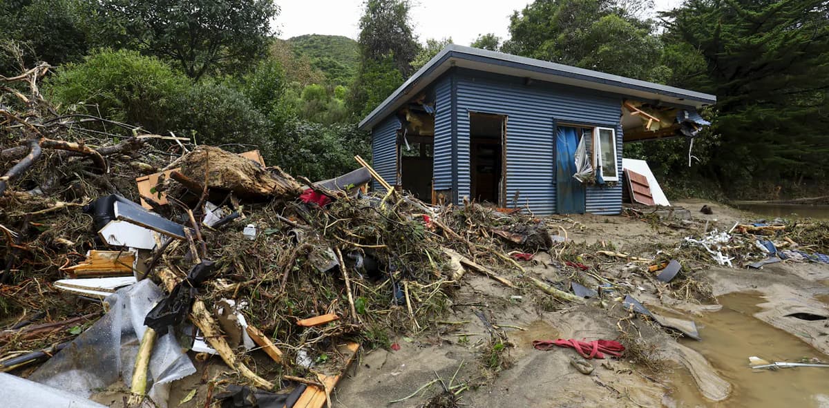
New Zealand’s steep terrain and fragile sedimentary rocks have long made landslides a deadly natural hazard, but a warming climate is intensifying the threat. Recent climate projections indicate that extreme rainfall events will become more frequent and severe, pushing already vulnerable slopes past critical failure thresholds. The economic toll—roughly $150‑180 million USD annually—combined with a death toll that exceeds volcanic and seismic disasters, underscores the urgency for better risk assessment and mitigation.
Cutting‑edge satellite platforms now deliver high‑resolution topographic, forest‑height, and land‑cover data at a scale previously impossible. By feeding these datasets into machine‑learning algorithms, researchers can identify the subtle environmental cues that precede slope failure. The resulting models not only map damage immediately after storms but also generate on‑demand hazard maps when paired with short‑term rainfall forecasts. This predictive capability transforms reactive emergency response into proactive risk management, allowing authorities to issue targeted warnings and allocate resources more efficiently.
The policy implications are profound. Accurate susceptibility maps inform land‑use decisions, such as where to expand permanent forest cover or restrict high‑risk development. They also help utilities and local councils evaluate the long‑term cost of maintaining infrastructure in vulnerable zones. As climate scenarios suggest non‑linear growth in landslide exposure, integrating these AI‑driven insights into national adaptation plans becomes essential for safeguarding communities and preserving economic resilience.
Climate change means more landslides in NZ – but new tech can help reduce the risk
Comments
Want to join the conversation?
Loading comments...