Full Moon Helps Paint Vibrant, Muddy 'Brushstrokes' In Indonesian River — Earth From Space
Why It Matters
The event demonstrates the power of satellite remote sensing to monitor rapid tidal and sedimentary changes that affect coastal stability and ecosystem health. Such insights are critical for climate‑adaptation planning and navigation safety in the region.
Key Takeaways
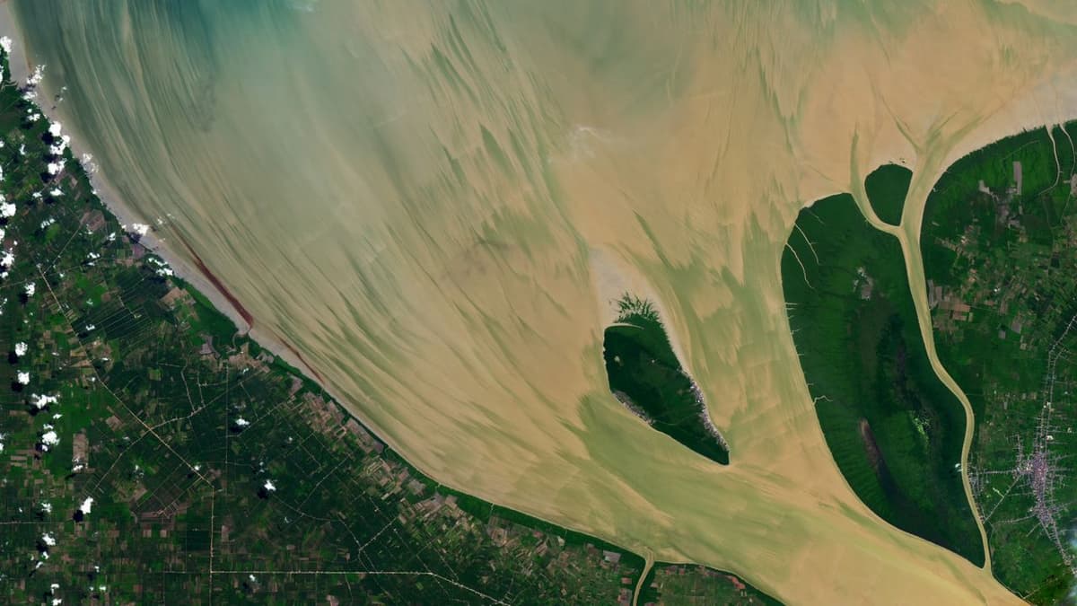
- •Landsat 8 captured brushstroke sediment patterns in Indonesia’s Rokan River.
- •Full “Strawberry Moon” triggered a 5 m spring tide.
- •Tidal bore moves sediment upstream, reshaping estuary shoreline.
- •Shoreline near Halang Island grows ~67 m annually.
- •Remote sensing tracks coastal change, aiding climate research.
Pulse Analysis
Satellite platforms like Landsat 8 have become indispensable for visualizing dynamic coastal processes that were once invisible to the naked eye. By capturing high‑resolution, multispectral images during a full "Strawberry Moon," scientists could observe a rare spring tide that raised water levels by five metres. This extreme tidal event amplified the river’s natural tidal bore, a surge that pushes water—and the sediment it carries—upstream. The resulting brushstroke‑like patterns are not merely aesthetic; they provide a real‑time proxy for measuring sediment flux and tidal energy in estuarine environments.
Understanding sediment transport is essential for managing Indonesia’s extensive river networks, which feed into critical shipping lanes and biodiverse mangrove habitats. The Rokan River’s estuary, for example, is expanding its shoreline at an average of 67 metres per year, a rate derived from multi‑year satellite comparisons. Such rapid accretion can alter navigation channels, affect fish spawning grounds, and reshape coastal ecosystems. Moreover, the interplay between tidal bores and spring tides accelerates erosion upstream while depositing material downstream, influencing flood risk and land use planning for nearby communities.
Beyond the immediate geographic interest, this case highlights how remote sensing supports broader climate‑adaptation strategies. Continuous monitoring of tidal ranges, sediment deposition, and shoreline migration equips policymakers with data to anticipate sea‑level rise impacts and to design resilient infrastructure. As satellite constellations grow in number and resolution, the ability to detect subtle yet consequential changes—like the Rokan River’s brushstroke patterns—will become a cornerstone of global coastal management and scientific research.
Full moon helps paint vibrant, muddy 'brushstrokes' in Indonesian river — Earth from space
Comments
Want to join the conversation?
Loading comments...