Lasers in the Sky: Hi-Tech Missions Track Record Snowpack Loss in US West
Why It Matters
Western water utilities and farmers depend on mountain snowpack as a natural reservoir; its rapid loss jeopardizes drinking water, agriculture, and fire safety, reshaping regional economies and policy priorities.
Key Takeaways
- •Lidar aircraft map snow depth with 3 cm accuracy.
- •California snowpack at 18% of historic average on April 1.
- •Early melt advances runoff, heightening fire and water shortages.
- •Colorado River reservoirs face critical deficits without winter snow.
- •Experts warn this snow‑drought could become the new norm.
Pulse Analysis
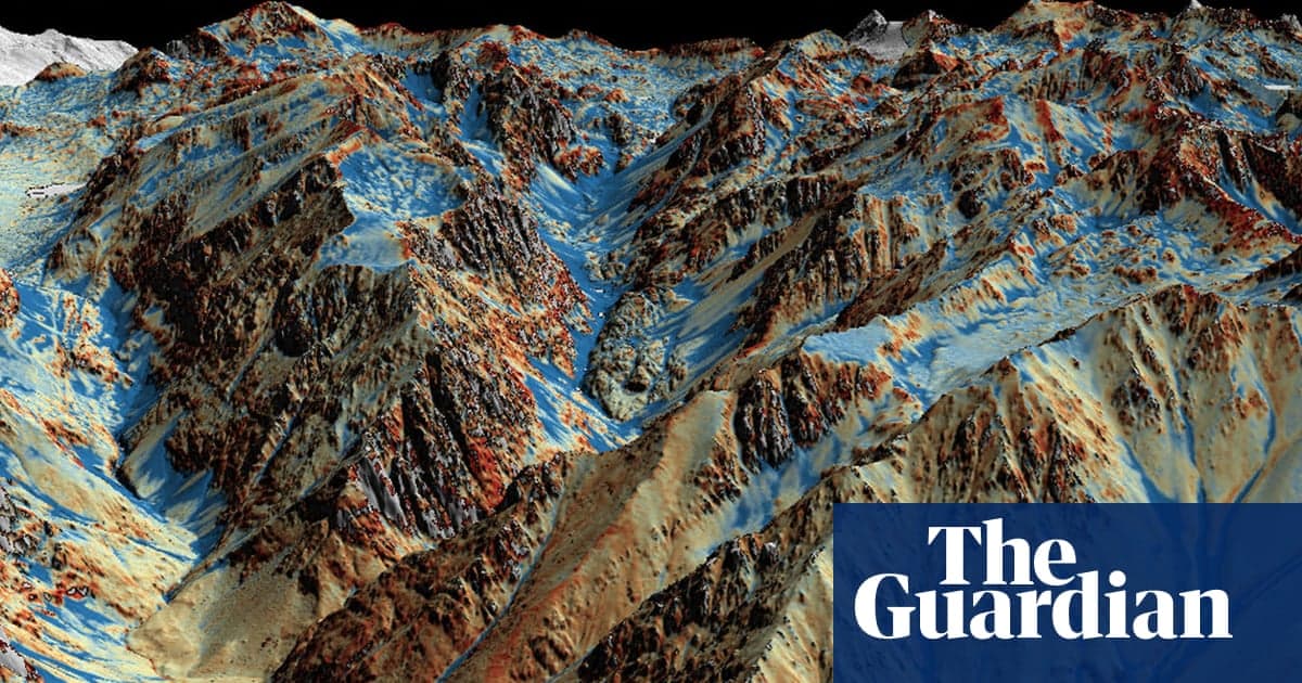
The Airborne Snow Observatories program, built on NASA‑derived Lidar technology, now flies laser‑pulse scanners that emit up to 800,000 pulses per second. By measuring the time it takes each pulse to bounce back from the snow surface, the system creates a 3‑D snow‑depth model accurate to within three centimeters. This precision far exceeds traditional satellite or ground‑based gauges, giving water managers a near‑real‑time view of the “frozen reservoir” that feeds the West’s rivers and reservoirs.
This spring’s data reveal a stark picture: California’s snowpack sits at a mere 18% of its long‑term average, and runoff is occurring roughly two months ahead of schedule. Early melt means that water is released before agricultural irrigation demand peaks, while reservoirs such as Lake Mead and Lake Powell remain critically low. The premature loss of snow also dries vegetation earlier, creating conditions ripe for large‑scale wildfires that threaten communities from the Sierra Nevada to the Colorado Plateau.
Beyond the immediate crisis, the findings underscore a broader climate trajectory. Researchers warn that the current “snow‑drought” could become the norm as warming winters and intensified heatwaves erode the seasonal snow cycle. Policymakers will need to invest in adaptive water‑management strategies, expand storage infrastructure, and rely increasingly on high‑resolution remote‑sensing tools like Lidar to anticipate supply shortfalls. The convergence of cutting‑edge technology and climate science is thus essential for safeguarding the West’s water security in the decades ahead.
Lasers in the sky: hi-tech missions track record snowpack loss in US west
Comments
Want to join the conversation?
Loading comments...