NASA's Curiosity Rover Gets Its Drill Stuck, Recordings From the Arctic Seafloor and More Science Stories
Why It Matters
The Curiosity incident underscores the challenges of autonomous planetary sampling, while the Arctic video study offers a cost‑effective blueprint for polar marine research, and the Artemis II photo dump fuels public interest and scientific analysis of lunar operations.
Key Takeaways
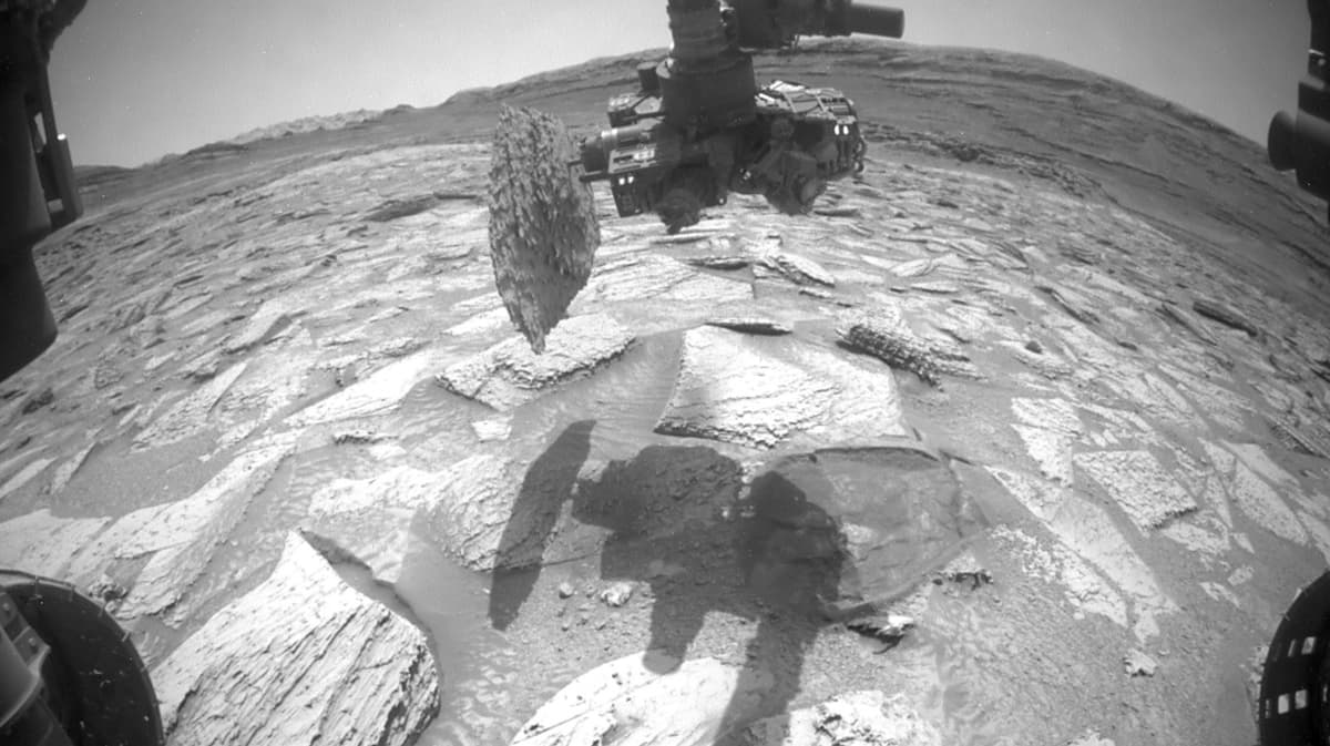
- •Curiosity’s drill snagged 30‑lb rock, first such incident in 14 years
- •NASA freed rock by tilting, rotating, and vibrating drill assembly
- •Arctic fjord study recorded 478 species using 260‑m deep video mooring
- •Researchers captured narwhal sounds and marine snow, highlighting ecosystem links
- •Artemis II archive released over 12,000 lunar, Earth, and Milky Way images
Pulse Analysis
The recent Curiosity drill episode highlights the mechanical limits of long‑duration rovers on another planet. After the drill bit lifted a 30‑pound slab of Martian rock, engineers employed a combination of tilt adjustments, rotational torque and high‑frequency vibrations to dislodge it. This first‑of‑its‑kind snag after 14 years of operation provides valuable data for future autonomous drilling systems, emphasizing the need for adaptable hardware and real‑time problem‑solving protocols as NASA prepares for sample‑return missions.
In the Arctic, researchers deployed a compact video‑camera and hydrophone mooring 260 meters below Inglefield Bredning’s surface, capturing a snapshot of deep‑sea biodiversity rarely seen in situ. The footage documented 478 distinct organisms, from comb jellies to snailfish, and recorded continuous narwhal vocalizations alongside the acoustic signature of melting ice. By proving that portable, low‑cost moorings can yield high‑resolution biological and acoustic data, the study paves the way for broader monitoring of climate‑sensitive Arctic ecosystems, informing both conservation strategies and climate‑model validation.
NASA’s release of over 12,000 Artemis II images serves a dual purpose: it fuels public fascination with space exploration and provides researchers with a rich visual dataset of lunar terrain, Earth’s limb, and the Milky Way. The high‑definition photographs, taken during the crewed Orion flyby, support geological mapping, surface‑hazard assessment, and future landing site selection for Artemis III and beyond. By making the archive publicly accessible, NASA encourages citizen science, educational outreach, and cross‑disciplinary analysis, reinforcing the agency’s commitment to transparency and collaborative discovery.
NASA's Curiosity rover gets its drill stuck, recordings from the Arctic seafloor and more science stories
Comments
Want to join the conversation?
Loading comments...