Scientists Catalog the ‘Fractal Dimensions’ of More than 130,000 Islands
Why It Matters
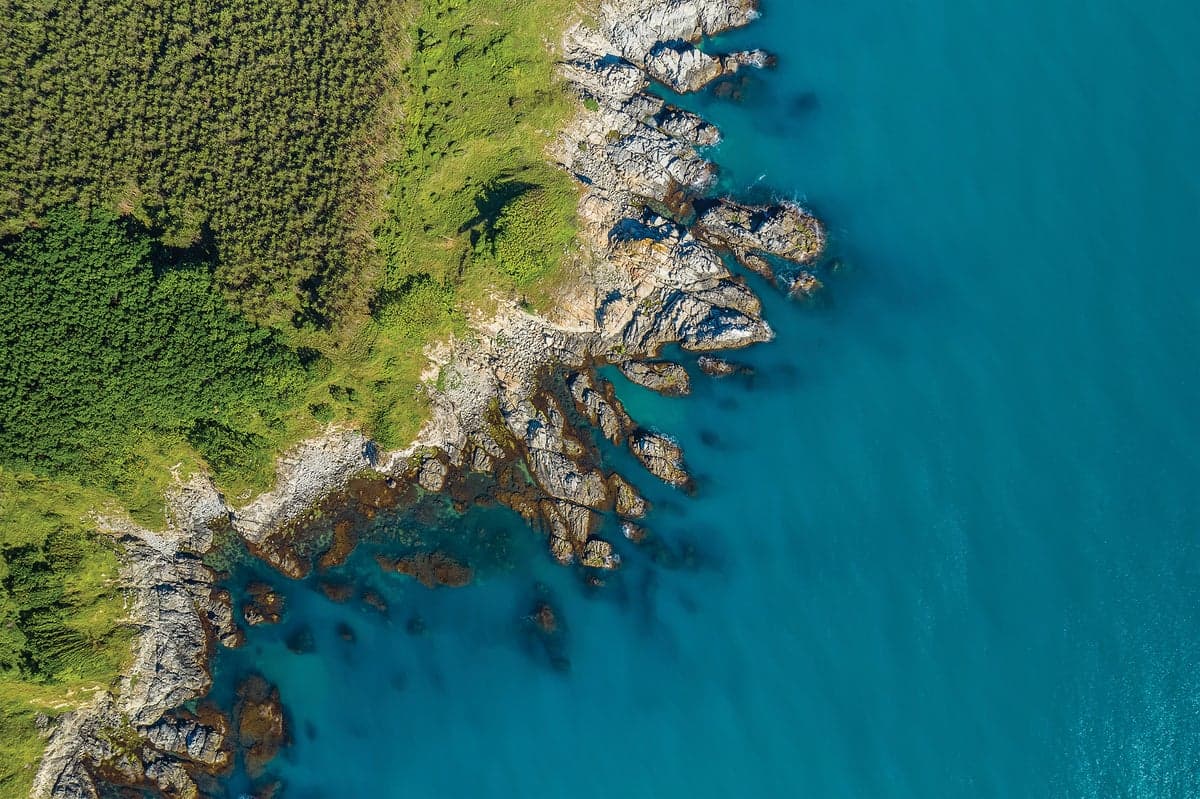
Understanding that coastlines are less fractal reshapes how scientists model erosion, sediment transport, and sea‑level rise impacts, improving predictions for coastal infrastructure and climate resilience.
Key Takeaways
- •Study analyzed over 130,000 islands worldwide.
- •Coastlines exhibit the lowest fractal dimensions among island features.
- •Elevation and volume retain higher fractal complexity.
- •Findings question traditional uniform fractal Earth models.
- •Results may refine erosion and sedimentation predictions.
Pulse Analysis
The concept of fractals—shapes that repeat at ever‑smaller scales—has long fascinated geoscientists, especially after Benoit Mandelbrot highlighted the "coastline paradox" in the 1960s. That paradox showed how a coastline’s measured length inflates as measurement units shrink, suggesting an infinite complexity. For decades, researchers assumed this property extended uniformly across Earth’s surface, using a single fractal dimension to model everything from mountain ranges to ocean basins. The new island‑wide analysis challenges that assumption, revealing a nuanced picture where different geographic features possess distinct scaling behaviors.
In the latest pre‑print now accepted by Geophysical Research Letters, Oline’s team stitched together high‑resolution topographic data for over 130,000 islands, calculating fractal dimensions for four key attributes: coastline length, surface elevation, size distribution, and volume. The results were striking—coastlines consistently showed the lowest fractal dimension, appearing smoother despite the classic paradox. By contrast, elevation and volume retained richer, more intricate patterns, indicating that vertical and bulk properties of islands preserve fractal detail at finer scales. This methodological rigor, praised by external experts, underscores that earlier models were more "toy" approximations than precise representations of Earth’s geomorphology.
The implications ripple through multiple domains. Coastal engineers and climate modelers can now calibrate erosion and sediment transport simulations with a more realistic fractal baseline, potentially improving flood risk assessments and shoreline management strategies. Moreover, the study invites interdisciplinary collaboration to integrate variable fractal dimensions into global Earth system models, bridging gaps between surface‑process theory and practical forecasting. As researchers explore how these differentiated scaling laws interact with sea‑level rise and human development, the findings promise to sharpen both scientific insight and policy‑relevant decision‑making.
Scientists catalog the ‘fractal dimensions’ of more than 130,000 islands
Comments
Want to join the conversation?
Loading comments...