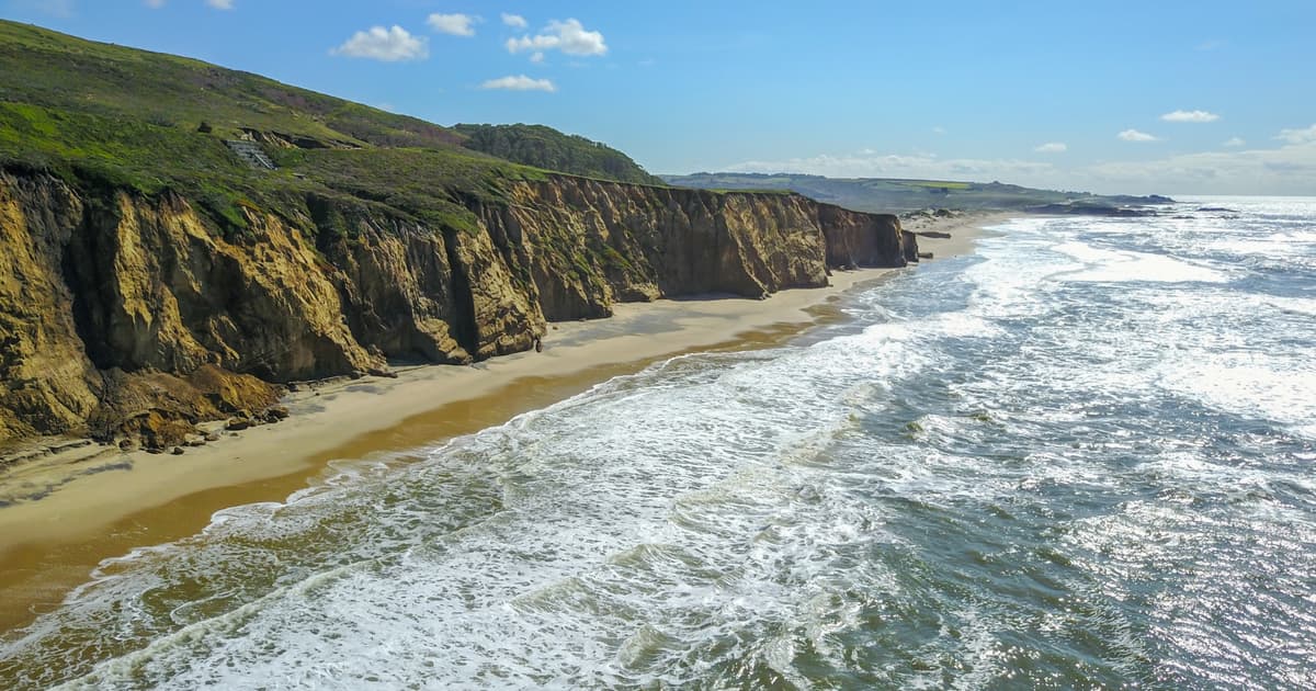
There Is an Entire Continent on Earth that Almost No One Has Ever Stood on — Zealandia, a 1.9 Million Square Mile Landmass East of Australia, Roughly Half the Size of the Continent It Sits Beside — but 94 Percent of It Is Submerged Under the Pacific Ocean, with only the Islands of New Zealand and New Caledonia Poking Above the Waves, and It Was only Formally Recognized as Earth’s Eighth Continent in 2017
Why It Matters
Recognizing Zealandia reshapes our map of continental crust and offers a natural laboratory for studying plate‑tectonic processes that created the Ring of Fire, informing resource exploration and climate‑history models.
Key Takeaways
- •Zealandia spans 4.9 million km², half size of Australia.
- •94% of the continent lies beneath the Pacific Ocean.
- •2017 IODP Expedition 371 drilled 2.5 km of core across six sites.
- •Fossil pollen reveals temperate forests existed 50‑80 million years ago.
- •Ring of Fire tectonics lifted and sank Zealandia, reshaping its crust.
Pulse Analysis
The formal recognition of Zealandia as the world’s eighth continent marks a watershed moment in geology. Though its crust stretches over 4.9 million square kilometres—roughly half the area of Australia—94 percent of this landmass is hidden beneath the Pacific, leaving only New Zealand, New Caledonia and scattered islets above water. The 2017 International Ocean Discovery Program expedition, using the JOIDES Resolution, retrieved over 2.5 km of sediment cores, providing the first direct physical evidence that the submerged plateau meets all four classic criteria for continental status. This breakthrough underscores how advances in deep‑sea drilling and seismic imaging can rewrite planetary maps that have been static for centuries.
Analysis of the cores revealed a complex tectonic narrative. Between 50 and 35 million years ago, portions of northern Zealandia rose a kilometre or two, supporting temperate forests, while adjacent regions simultaneously sank. This vertical re‑organisation aligns precisely with the formation of the Pacific Ring of Fire, suggesting that the massive subduction‑zone re‑orientations that birthed today’s volcanic belt also fractured and reshaped Zealandia’s crust. By about 25 million years ago, the continent had largely subsided to its present depth, leaving a thin (~20 km) continental slab that is unusually shallow compared with typical continents.
The implications extend beyond academic curiosity. Zealandia offers a living laboratory for studying how continental crust can thin, fragment, and become submerged—a process relevant to resource exploration, seismic risk assessment, and climate‑change reconstructions. Its fossil pollen record enriches our understanding of ancient Southern‑Hemisphere ecosystems, while detailed bathymetric maps guide future offshore drilling and potential mineral extraction. As researchers continue to map this hidden continent, Zealandia will likely influence theories of plate dynamics and the long‑term evolution of Earth’s surface.
There is an entire continent on Earth that almost no one has ever stood on — Zealandia, a 1.9 million square mile landmass east of Australia, roughly half the size of the continent it sits beside — but 94 percent of it is submerged under the Pacific Ocean, with only the islands of New Zealand and New Caledonia poking above the waves, and it was only formally recognized as Earth’s eighth continent in 2017
Comments
Want to join the conversation?
Loading comments...