Companies Mentioned
Why It Matters
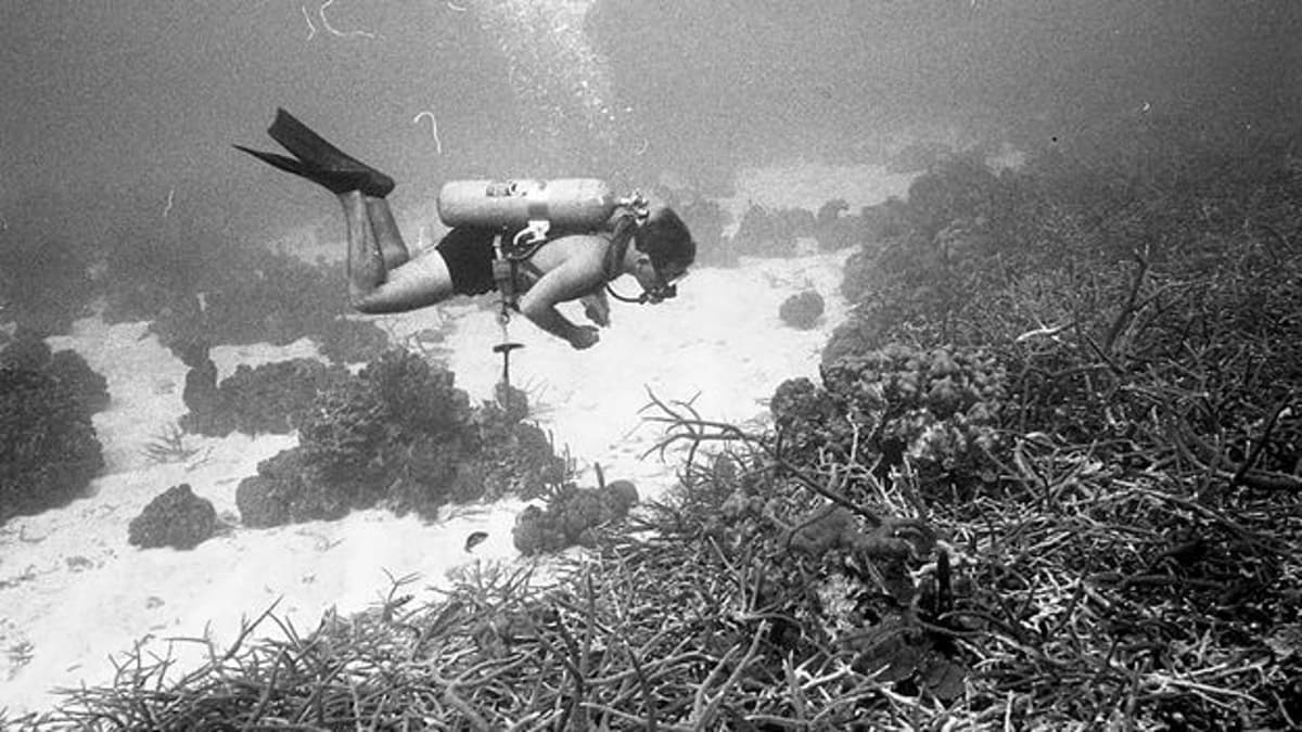
The images reveal the scale of Caribbean reef loss, giving policymakers and conservationists a concrete reference point for ambitious restoration and climate‑adaptation strategies.
Key Takeaways
- •1960s photos show 80‑90% coral cover in Jamaica’s reefs
- •Today coral cover dropped to 10‑20% in same locations
- •Historic images combat “shifting baseline” syndrome for marine conservation
- •Mangrove restoration is central to reef recovery and carbon sequestration
- •Climate‑driven storms and overfishing accelerate reef degradation
Pulse Analysis
Coral reefs worldwide have lost up to 50% of their live cover since the 1980s, yet many managers still base restoration targets on recent, degraded snapshots. The rediscovered archive of more than 1,000 analog photographs taken by marine scientist Eileen Graham in Jamaica during the mid‑1960s offers a rare, high‑resolution baseline of what a thriving Caribbean reef looks like. Those images capture 80‑90% live‑coral cover, dense sea‑fan forests, and bustling schools of snappers and groupers—a visual contrast to today’s 10‑20% cover. By quantifying that historic richness, researchers can calibrate models, set realistic recovery goals, and counter the “shifting baseline” bias that normalizes loss.
Jamaica’s reefs have been battered by a cascade of stressors: Hurricane Allen in 1980, the 1983 mass die‑off of the keystone sea urchin Diadema antillarum, chronic pollution, and a tourism boom that harvests algae‑grazing fish. The most recent Category 5 Hurricane Melissa, with 185‑mph (295 km/h) winds, ripped coral structures and accelerated shoreline erosion, reminding locals that white‑sand beaches are largely the product of historic reef calcification. Scientists now link mangrove loss to reef decline, prompting the Jamaica Mangroves Plus Project to restore coastal forests that act as nurseries, carbon sinks, and natural breakwaters. Early results show improved water quality and modest coral recruitment in adjacent zones.
The visual proof of Jamaica’s lost underwater paradise is reshaping policy conversations across the Caribbean. Tourism operators are beginning to market reef‑friendly experiences, while governments consider integrating historic baselines into marine protected‑area design and climate‑adaptation funding. Moreover, the archive underscores the urgency of preserving scientific collections before they deteriorate, a lesson echoed by institutions worldwide that are digitizing analog marine data. As climate models predict that 80‑90% of global reefs could disappear by 2050, the combination of historic reference, mangrove restoration, and targeted resilience research offers the most viable pathway to safeguard both biodiversity and the economies that depend on it.
These 1960s photos reveal Jamaica's lost paradise
Comments
Want to join the conversation?
Loading comments...