Urban Ecological Corridors: Connecting Forest Fragments Associated with Protected Springs in the Southern Amazon
Why It Matters
The analysis provides concrete spatial guidance for green‑infrastructure and biodiversity strategies, helping cities balance growth with ecosystem resilience.
Key Takeaways
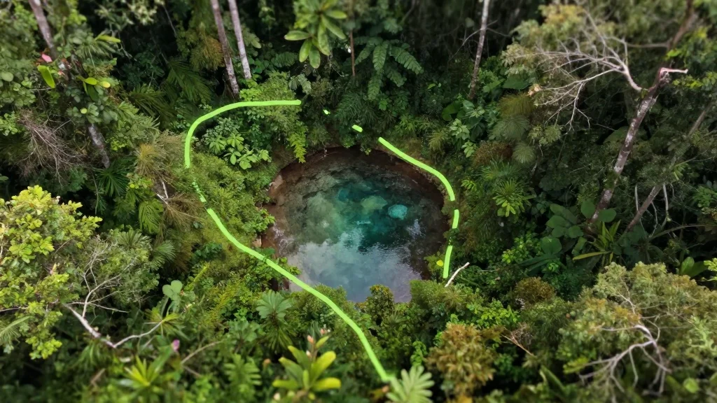
- •Saracura II and Buritis springs host the largest forest fragments
- •Central‑southeastern zones show the lowest landscape resistance
- •Least‑Cost Path modeling reveals viable arboreal movement corridors
- •Study offers a replicable framework for urban Amazon conservation
Pulse Analysis
Rapid urbanization in the Amazon has fragmented native habitats, jeopardizing the movement of species that rely on continuous forest cover. In Alta Floresta, a city perched on the southern edge of the rainforest, researchers combined high‑resolution land‑use maps with landscape‑ecology metrics to quantify how urban features impede arboreal fauna. By applying the Analytic Hierarchy Process, they weighted variables such as land use, permanent preservation areas and slope, creating a resistance surface that feeds into Least‑Cost Path analysis. This methodological blend pinpoints where the urban matrix still permits ecological flow.
The modeling uncovered a network of low‑resistance corridors that stitch together multiple forest patches surrounding protected springs. Notably, the 15.04‑hectare Saracura II and 14.51‑hectare Buritis spring fragments emerge as structural hubs, acting as stepping stones for wildlife. These corridors concentrate in the city’s central and southeastern sectors, where vegetation patches are denser and topographic slopes are gentler, reducing movement barriers. The study’s granular spatial outputs enable planners to visualize exact routes that could be reinforced through reforestation or riparian buffers.
Beyond the local context, the research offers a scalable blueprint for other Amazonian municipalities facing similar pressures. By integrating ecological connectivity into zoning decisions, municipalities can design green infrastructure that safeguards biodiversity while accommodating growth. The approach also aligns with Brazil’s national commitments to preserve ecosystem services and supports international climate and conservation agendas. Ultimately, the work demonstrates that proactive, data‑driven planning can preserve functional landscapes even amid rapid urban expansion.
Urban Ecological Corridors: Connecting Forest Fragments Associated with Protected Springs in the Southern Amazon
Comments
Want to join the conversation?
Loading comments...