U.S. Weather Agency’s New Mobile Fleet to Provide Rapid Storm Insight
Why It Matters
Deployable high‑resolution radar shortens the gap between storm development and warning issuance, directly enhancing NOAA’s ability to protect lives and property during extreme weather events.
Key Takeaways
- •NOAA adds three mobile radars to its research fleet.
- •X‑band radars capture finer precipitation particles, enhancing tornado detection.
- •C‑band radar improves heavy‑rain measurement for flash‑flood forecasting.
- •Dual‑view scans resolve wind speed and direction more accurately.
- •Mobile units support wildfire smoke monitoring and firefighter safety.
Pulse Analysis
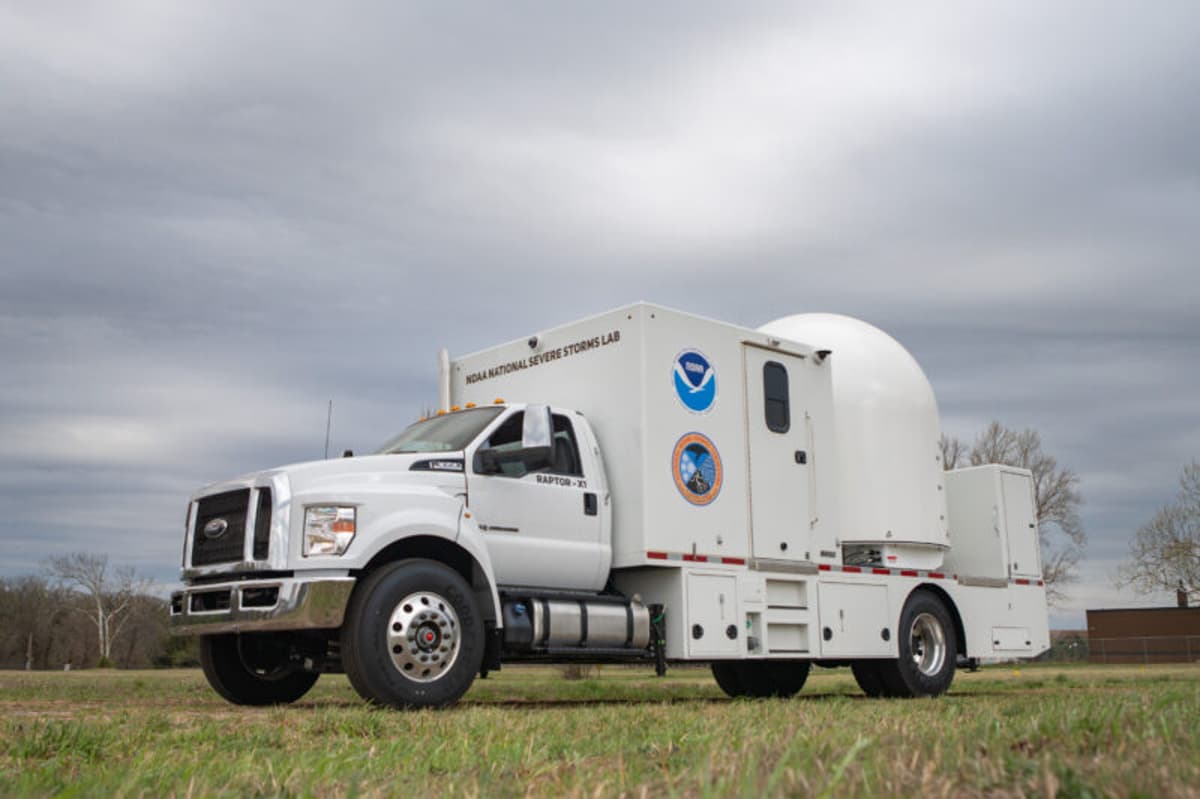
NOAA’s National Severe Storms Laboratory has just expanded its mobile observing fleet with three state‑of‑the‑art weather radars. Mounted on heavy‑duty trucks, the units can be driven to the vicinity of tornadoes, wildfires, flash‑floods or severe wind events, delivering research‑grade data in real time. This mobility bridges a long‑standing gap in the agency’s fixed‑site radar network, which often misses low‑level storm features that develop minutes before impact. By positioning the radars at the front lines, scientists gain a clearer picture of hazardous weather as it unfolds.
The new fleet comprises two X‑band radars and one C‑band radar, each chosen for complementary strengths. X‑band’s three‑centimeter wavelength excels at detecting small hydrometeors, allowing forecasters to see the fine‑scale debris signatures that precede tornado formation. The C‑band unit, with a five‑centimeter wavelength, handles heavy precipitation and larger particles, improving quantitative rain estimates for flash‑flood warnings. Moreover, operating multiple radars on a single storm provides dual‑view observations, enabling precise vector wind calculations that fixed radars cannot achieve alone.
Beyond academic insight, the mobile radars are poised to sharpen NOAA’s operational forecasts and protect lives. Real‑time data on storm structure can be fed directly into warning models, extending lead times for tornado and flood alerts. In wildfire scenarios, the radars can track smoke plume dynamics and fire‑induced wind shifts, informing evacuation decisions and firefighter tactics. As climate change drives more extreme events, the ability to deploy high‑resolution radar on demand will become a critical tool for both emergency managers and the broader meteorological community.
U.S. Weather Agency’s New Mobile Fleet to Provide Rapid Storm Insight
Comments
Want to join the conversation?
Loading comments...